Friday, January 25, 2013

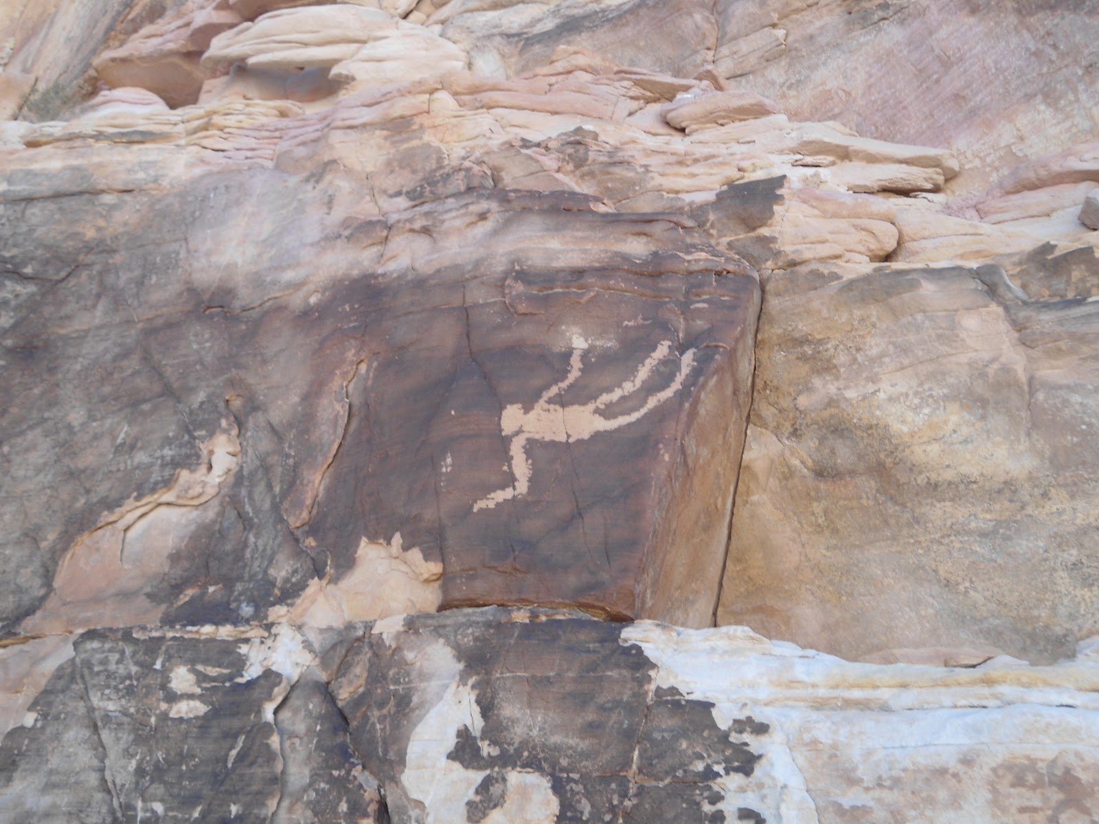
Falling Man (Whitney-Hartman petroglyph site)


Jan 17, 2013

The weather was just turning warm enough for a hike, and with the destination being in the Mesquite, Nevada area where the temperature is a couple of degrees warmer than where we live, it was time to check out some petroglyphs. I had read a newspaper article about the Falling Man site, as the Whitney-Hartman site is commonly referred to, a week or so before the hike and used the directions in it to find my way.

We took I-15 south out of St George, Utah and followed it 5 miles past Mesquite to exit 112, which is the Riverside/Bunkerville exit. Once off the freeway, we took a left at the stop sign and headed towards Bunkerville. After about 3 miles, the road/minor highway crosses the Virgin River and immediately past the bridge crossing the river is an intersection which is unmarked, unless I just missed the sign. Regardless, the road is Gold Butte Road. Take a right onto Gold Butte Road and continue on this paved, yet rough and not well maintained, road for another 20 miles. After about a mile on the road, you'll come to a melon farm; after about 10 miles you'll see someones residence which looks like an oasis; after 14 miles you'll see Lake Mead off in the distance ahead of you, which makes for a awesome view; and finally at 19.9 miles the turn off will be on the right hand side.
The Black Butte Road turn off with the red rock formation in the background

The road is called Black Butte Road, although it is not marked. The best way to be on the look out for it is to just remember that when you see a giant red rock formation directly ahead of you, take the small, unassuming dirt road off to the right which will, again, be 19.9 miles from when you started on Gold Butte Road. This is a rough single track dirt road. I made it in my Honda Accord with some creative driving, but I would definitely recommend a high clearance vehicle.
The parking area.

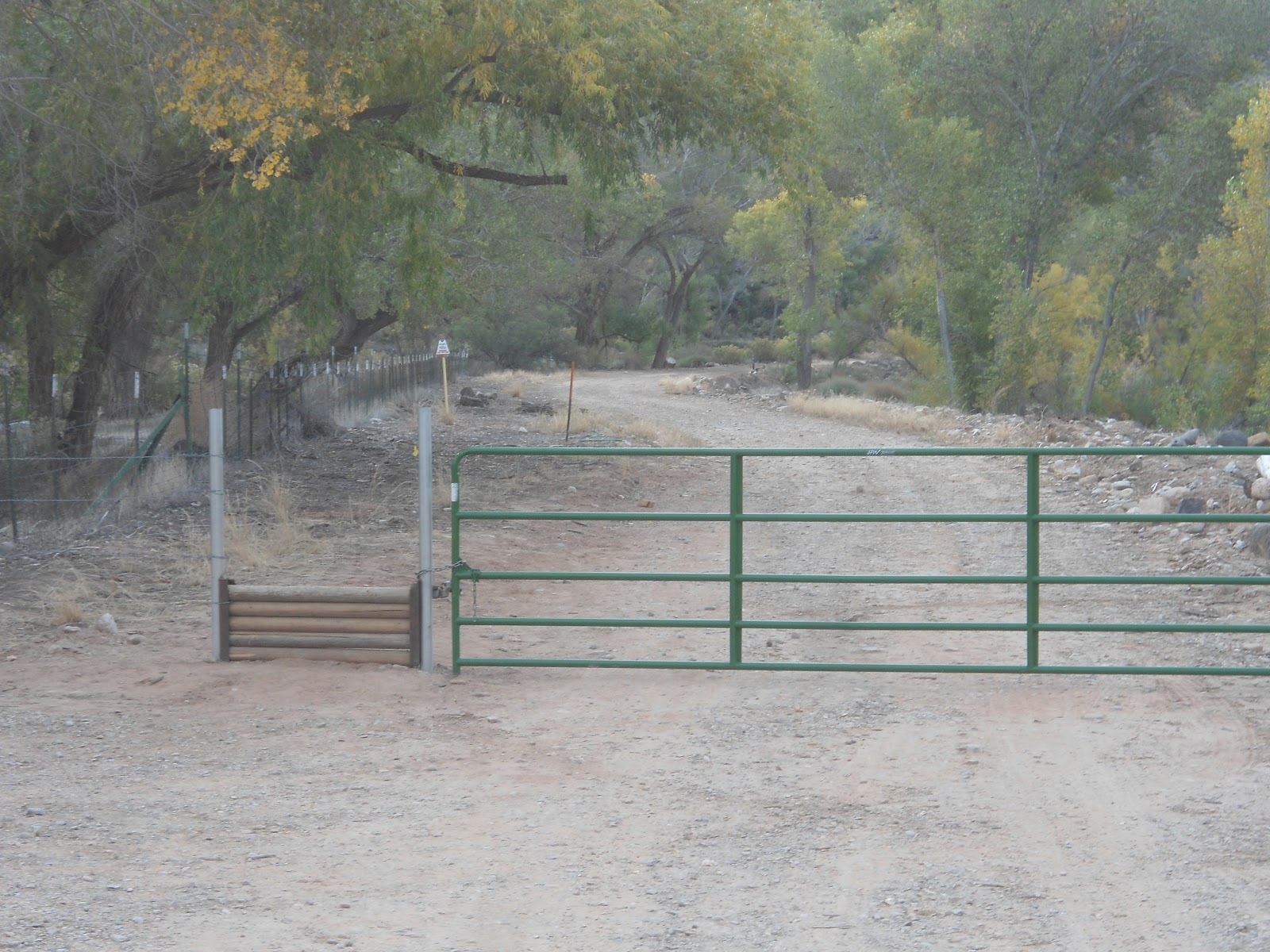
After 1.2 miles on the dirt road it forks. Take the left fork and continue another .7 miles to the parking area surrounded by a wooden fence. Although the road continues through the fenced area, park at the fenced area and look for a small break in the fence just wide enough for a hiker to get through.

Crawling through the window to get to the Falling Man petroglyph.
The trail is easy to follow at first as it leads you past a number of small rock formations. We explored a few of them and found some minor petroglyphs. To get to the Falling Man petroglyph, continue straight on the main trail until it seemingly ends in a cul-de-sac fashion. From here, if you veer slightly to the right, you'll pick up a faint trail that heads in the direction of a large rock outcropping. As you get closer to the outcropping, if you look closely you can see some more petroglyphs, and a window through the rock to the other side. Scramble up to the window and crawl through, as the Falling Man is just a hundred feet or so through it.


Falling Man
Once through the window, follow the narrow ledge to the left and see if you can spot the Falling Man petroglyph about 8 feet up on the wall by the ledge that you're on. It's not extremely large - maybe about a foot or so long - but it is very distinct. There are no other petroglyphs in the immediate area surrounding the Falling Man, but if you continue scrambling down for a few hundred yards and then head left up a small side canyon, you'll find the best panel of petroglyphs in the area. They are high up on the rock ledge - actually there are 3 different levels of the ledge that they're on. We found a way to hike up to them all.

There are probably plenty of petroglyphs that we missed, but we were happy to see what we did. Part of the fun of being there was just imagining how the early people used to live in the very area that we were exploring. We tried to imagine what plants they lived off of, what animals they ate, where they slept, etc. It was a great experience. Our total hiking distance was minimal - maybe 2 miles at most, with a little easy scrambling/climbing that just about anyone could do.
This is where it gets hard to figure out where to go. I'm at the portion of the main trail that seemingly ends in a cul-de-sac fashion. In the picture, I am pointing the way to go to get to the window.

The faint trail that leads up to the window that you have to pass through to see Falling Man and the main panel of petroglyphs.

Climbing up to get to the main panel of petroglyphs.

The lower level of petroglyphs.

Me at the first (lower) level of petroglyphs.

Second level of petroglyphs.

Liz at the second level of petroglyphs.
The third level of petroglyphs, higher up on the wall.

Let the exploring begin!

Exploring on the top of the rock formation.

A picture of what the trail looks like just after passing through the gap in the fence.


Thursday, November 15, 2012

Coalpits Wash

15 Nov 2012

With the weather warm enough for me to attempt a longer hike, I thought I'd give Coalpits wash an attempt. I had wanted to do Coalpits for some time to check out the oil ruins left from a failed drilling attempt many years ago.

The trail head is located just across the bridge spanning the small Coalpits wash, just on the east side of the bridge. The bridge is signed, and there is a small parking area on the north side of the highway. A NPS fence leads to a wooden hikers gate and a trail sign.

I started on my way 5 minutes before 9:00. With the temperature in the 40's, my hands were freezing and I would look forward to the section of trail that was exposed to the sun. I thought about how I would be thinking the exact opposite had I been attempting this hike in the middle of summer!

The well-defined trail was covered with leaves from the overhead trees. After about a half mile, the trail crosses two small but steep ravines and wanders under power lines. A third small ravine is crossed and a small post sign is passed indicating that I was entering the Zion Wilderness area.

Campsite 6. This is where you leave the trail and head across the wash on the left.
After 1.75 miles, I came to the confluence of Scoggins and Coalpits washes. The first time I attempted this hike about 4 months ago, I ventured to the right, following the main trail. Unfortunately, a few miles later, I realized that this was Scoggins Wash that I had followed. The confluence is marked with a campsite marker, number 6. When you come to this marker, cut across the wash and head up the wash on the left where the bigger water flow is coming from.

Round, prickly balls of death that kept attaching themselves to my socks.
From here, the views of Cougar Mountain ahead shortly open up and it seems like an insermountable task to get there. But that's where the trail takes you - until it curves right along it's south wall. At this point there are a couple of options.There isn't much of a trail so you can make your way up the river itself, which would be slow going, or try to find the faint game trails up on the benches. For the most part, I followed deer tracks since I figured they would probably know the easiest way through the brush. I ended up stopping what seemed like every 50 steps to pull round prickly balls of death out of my socks. (Yes, the name I gave them is a little overly dramatic but, after a while, it was a pain in the behind to pull them out of my socks. I would get pricked in my ankles about 10 times before I finally cried 'uncle' and stopped to pull them out, only to get pricked in each finger as I pulled them out).

When the trail brought me back to the river, some of the pools were frozen over and in some spots, heavy frost lined the river bank. There were many small picturesque waterfalls along the way as well. After about 3.5 miles, the wash turns into a mini canyon of sorts with rock walls enclosing the river course. I hadn't gotten my feet wet yet, so I bushwhacked my way onto the rim, just about 30 feet above the river, and made my way around the narrow reed filled river that way. Since coming back from my hike, I've heard that "coalpits spring" is found coming out of the rock in this short portion of the hike and that it results in a mini hanging gardens. Next time I will have to hike up the river to check it out.
The cairn marking the Chinle Trail junction.
Just past this part, and 3.8 miles from the trail head, the Chinle Trail comes in from the right. It is well marked by a large cairn on the river bank and another large cairn and small post sign off the river.

The next interesting landmark that I was supposed to come to (5.5 miles from the trail head) was the oil ruins. I was expecting to see something like the cable works at Cable Mountain, but on my way up the wash, I actually missed the ruins.

The falls before the hanging gardens.
I continued up the wash and after 7.9 miles came to some really pretty falls that winded around beneath some spectacular hanging gardens. Just past the hanging gardens was another waterfall preceded by a small pool. To get up the waterfall (about 6 feet tall) I had to get my feet wet for the first time before climbing up the mossy rocks.

I made it up and quickly came to another 6 foot waterfall that I bypassed by climbing up the wall on the right. After 8.2 miles I came to a fork in the wash. Since I left my map at my house, I wasn't sure which one was Coalpits. Water flowed from both forks. I decided to follow the one on the right, which had less water flowing from it. With time running out to make it back to a dinner appointment, I knew I wouldn't have much longer to explore. I went up the wash for a few hundred yards and it looked as though the wash was extremely overgrown with brush, so I decided to turn around. (Upon looking at my map when I got home, I realized that Coalpits actually was the the one on the left and ended not much farther up stream).

Oil Ruins
The way back was long and my legs were showing the effects of not having been on a long hike for a couple of months. I did, however, manage to spot the oil ruins on the east side of the river, up on a bench about 15 feet above the river. They were neat to see, but again, not what I was expecting.

I got back to the car about 4:15 after 16.5 miles. The trail admittedly isn't as scenic as most of the hikes I have been on, but it did have it's interesting points. Doing this hike in the summer would be brutally hot and the fall proved to have it's downside as well with all the burrs and bristles falling off their plants and easily finding my socks. Spring would seem to be the best time to do this hike.
One of the many falls on the hike.

My hiking stick on a frozen pool.

Looking north towards Cougar Mountain.

A portion of Coalpits wash near the junction with the Chinle Trail.

A picture of the partially frozen river.

The falls before the hanging gardens.
A close up of the hanging gardens.


The first 6 foot fall. To get passed it, I climbed up the rocks just to the right of the water fall.
The second 6 foot fall. To get passed this I climbed a thin ledge on the rock to the right.

At the end of my hike. I took the right fork for a few hundred yards although Coalpits Wash continues on the left fork.

 
Another picture of the oil ruins.
 

Thursday, November 1, 2012

Confluence Trail to La Verkin Creek Trail to Chub Trace to Tortoise Track to Confluence View Trails, Confluence Park

Nov 1, 2012

With a little of Confluence Park explored last week, Liz and I thought we'd explore a bit more of it this week. The Park its self has 10 different trails in it and Liz and I would be covering five of them on this hike. We took two cars and parked one of them (our pick up car) at the Main Street Trail head in Hurricane. To get there, follow main street north from SR-9 in Hurricane until it ends in an undeveloped neighborhood at a trail head marker. The marker here is an historical marker of the early exploration of the Hurricane area by Parley P Pratt.
Parking area and trail head
Once we parked our car at the Main Street trail head, we headed to 900 North in LaVerkin, took a left, and then followed the signs to the newly developed trail head. At the trail head there are restrooms and a large sign with a map of all the trails as well as a little history on the area. The Trail head is large and the trail starts at the far end, following a dirt road. A large green gate blocks the way for motorized vehicles, but a little hikers pass allows hikers access to the trail/road.

The main dirt road is Confluence Trail. We took this road for about a third of a mile until we came to a sign post indicating that the La Verkin Creek Trail went off to the right. The La Verkin Creek trail starts out as a pretty well worn hiking trail as it takes you to the confluence of La Verkin Creek and the Virgin River. From this point though, the trail disappears and for a time we even contemplated crossing the river at this spot. Instead, we decided to follow the river bank upstream and ended up periodically finding what appeared to be faint game trails. We followed them, parallel to the Virgin River until we could see the road that we started out on (Confluence Trail). We walked back to Confluence Trail and noticed that back to the left there was an old building. We decided to back track a bit to check it out. It was the old Historic Dairy Barn. We checked it our for a little bit, then turned back around and continued on our way. About a quarter mile past the Dairy Barn, we came to the Anasazi Cave Overhang. At this point, the Cactus Cliff trail joins the Confluence Trail and the junction is signed.

Grain storage site with volcanic outcropping to the right
The next landmark we came to was the Historic Grain Storage Site, about a quarter mile past the Anasazi Cave. The granary stored grain for the turkey farm. This was the coolest part of the hike. Just off to the side of the storage site is a really cool volcanic rock formation that we spent about 30 minutes exploring.

Hydroelectric Power plant
Past the Grain Storage site, the trail continues on the river bank for about another third of a mile until you get to the Hydroelectric Power station. This power station was built in 1929 and was in operation until 1983. It was another highlight of the hike.

After checking out the old power plant, we decided to ford the river and find "Chub Trace" a .6 mile trail that would take us back to Tortoise Track, the trail that leads to our car. The current of the river was strong in spots and the water was cold, but we made it across without incident. We then bushwhacked our way for a short time until we came to the trail we were looking for, which was pretty faint.

We came to the junction with the Tortoise Track, took a left and started up the hill until we came to the Confluence View Trail which is where our car was parked.

Because we are familiar with the area, we had no problem navigating our way back to where we needed to go, even in the absence of a trail in spots. But for the most part, the trails are pretty easy to follow, especially the Confluence Trail and the Tortoise Track, which are actually jeep roads. In total, the hike was about 3.5 miles.

This is how different points of the trails were signed
Liz is in the center of the volcanic rock "fort"
Liz, making her way through a fissure in the volcanic rock
The granary from above (on the volcanic rock)

The sign at the trail head
The gate at the trail head


Thursday, October 25, 2012

Confluence View and Tortoise Track, Confluence Park

25 Oct 2012

With the days getting shorter and hiking season nearing an end, I knew I wanted to go on another hike, but it would have to be a short one. I decided on Confluence Park in Hurricane.

Confluence Park is a 344 acre unmaintained park managed by Washington County and contains 10 different hiking trails. Some trails are as short as .3 of a mile and some as long as 2 miles. Of course, you can combine multiple trails and make a longer hike if desired. Within the park, the Ash Creek and La Verkin Creek drain into the Virgin River.

There are a number of different trail heads. I have always gone to the trail head at the end of 200 West in hurricane. To get there, go north on 200 West off of State Street and take the road until it ends. The last few hundred yards are on a well maintained dirt road past a few homes on the right. There will be a place to park your car by pulling off to the side of the road.

The fence marking confluence park
Liz and I started our hike down the dirt road about 10:55. Shortly we came to a small fence that marks the beginning of Confluence Park. This hike has always been a favorite hike of my kids, ages 6, 5 and 3, although they hiked it also when they were much younger with me. Liz and I were going to do a slight variation of the hike I normally take my kids on.

The normal route which starts from the parking area at the end of 200 West is on a trail called Tortoise Track. It gets it's name because it finishes by the desert tortoise preserve. The last time my kids and I were down there last summer, a worker was in the preserve (an open area surrounded by barbed wire fences) feeding and watering the tortoises. He let my kids and I come it and view the tortoises up close. It was a great experience for my kids.

This is the intersection where the Confluence View trail intersects the Tortoise Track trail.
The Tortoise Track heads straight while the Confluence View turns off to the left.
Instead of taking Tortoise Track on the way down, Liz and I decided that we would take the Confluence View trail. The Confluence View Trail intersects the Tortoise Track trail, but actually starts at the end of Main Street in Hurricane. That trail head is marked with a plaque that has some interesting information about the scouting out of the area by Parley P Pratt to see if it was suitable for settlement.

The Confluence View Trail intersects Tortoise Track just a few hundred yards past the fence and it is a faint old jeep road where it crosses. We took a left and went down hill towards the Virgin River. The Confluence View trail winds down under the cliffs we had just been on. The cliffs over head cast a shadow on the trail and both Liz and I were anxious to get back to the sunlight to warm up a bit.

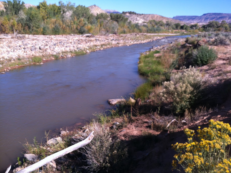
The Virgin River from the trail.
Once the trail makes it down to the river, it intersects the Virgin River Trail, which is marked by a trail sign with no name. We headed up stream on the trail until we got to the normal spot where we take the kids to play in the river. At this point, the fence to the desert tortoise preserve is visible. Liz and I spotted 3 tortoises that had come out of their tunnels to sun themselves.

Once past the desert tortoise preserve, the trail splits and the one that heads up the hill (and back to the car) is the Tortoise Track trail. We headed back up the hill and made it to our car at 11:55. Our total hike was abut 1.3 miles. This will be a fun area to explore further.
The view at the start of the hike.

Thursday, October 18, 2012

The Watchman, Zion National Park

18 October 2012

I was in the mood for an easy hike so I thought I would try The Watchman again. The Watchman was the very first hike I ever went on in Zion National Park about 15 years ago. I had forgotten a little what it was like, so I thought I better make it's acquaintance again.

Liz and I got to Zion National Park about 11:00, got our passports stamped and got on our way about 11:15. The trail head starts just across the bridge that leads to parking and the visitor's center, and is signed from the road. We parked in the dirt parking lot because the trail runs along the west side of it which makes it easier to access.

After just a quarter of a mile, the trail crosses a service road and starts the ascent to get to the look out point. The trail is extremely well maintained and is easy to follow, much of it covering man made stairs and flattened ground. In fact, we passed 6 park rangers maintaining the trail on our way up.

As the trail ascends, it follows the north side of a side canyon, until it wraps around to the south side and continues up to the look out point. We spent a few minutes at the top taking in the beauty and getting a neat birds eye view of the layout of the visitors center, movie theater, museum, and lodging for the National Park staff. It is really the best view of the layout from above of any of the hikes I've been on in the park.

We made it back down to the car at 12:45 after 3.13 miles. (The trail head sign indicates that the round trip hike is 2.7 miles, but my GPS registered it being a little longer). There was a total elevation gain of just over 400 feet. This is a great family hike as it is not very difficult. Although the morning was cool when we started, by the time we finished, it was warmish. The hike is completely exposed to the sun so bring lots of water if hiking it in the summer. 
Looking up canyon. Foreground: Staff Lodging. Background: Zion History Museum
Looking down canyon. On the left: Dirt parking area where the trail starts off to the far side, and where I parked. Background: The movie theater. And in the trees in the middle is the Visitor's Center.
Liz looking out over Zion Canyon
Me with Springdale in the background