*Updated July 2023 at the end
 r hiking shape, but overly anxious to get out there.
I tried to find my topo software to download to my GPS but it has been misplaced in the 2 moves we’ve had in the last year. So I was going blind into a mountain range I had never set foot it – a great situation for someone who gets lost in a bathroom. . . I did have a hard copy of a map of the Pine Mountain Wilderness, so I did have something to refer to.
I got on the road at about 8:00 and took I15 north to exit 22 in Leeds. Then head west on Silver Reef Road for about 8.6 miles until you reach the Oak Grove Camp Ground. While on the unpaved Silver Reef Road, you’ll encounter a fork in the road after about 3 miles. The left fork heads to St. George so stay right! Once to the camp ground there is a small parking area off to the right side of the road after passing a couple of camp grounds.

The Trail Head is well marked and is even visible from the road. I parked, used the rest room and headed up the trail at about 8:55. The sign indicates that it is 3 miles to the summit trail.
After ½ a mile, a sign marks the Pine Valley Wilderness. The first 3 miles to the summit trail are at a fairly steep grade and I was a little concerned when I started feeling it in my legs much sooner than normal. At about 9800 feet I reached the top of the ridge I had been looking at in agony for the past couple of miles, only to see the trail descend the other side – a frustrating thing for me, to lose elevation I had just gained.
I should mention that the trail for the f
 irst 3 miles was well defined and easy to follow, but after dropping over the ridge at 9800 feet, it became a little harder to follow. There were a few sporadic cairns to help but I did have to use some route finding to get back to the trail.
At about 9600 feet I saw a sign that was facing the other way. As I walked around to see what was on it, it pointed to Further Water off to my left and Whipple Camp Ground, I think, to the right. I knew I needed to go to Further Water, so I made a left.
I soon made my way to Deer Flat, 2 pretty meadows surrounded by pines in all direc
 tions. Once out of the meadow, the trail began climbing again at a gentle pace. After about another mile I came to Further Water. I had to cross a small stream, running from the spring at Further Water. This was an even bigger meadow that Deer Flat and very pretty too with a small stream running down the left side of the trail for a while.
Once through Further Water, the trail climbs rather steeply for a little bit. After a few hundred yards, a series of cairns are staggered along the fairly well defined trail. Near the cairns, there is a small wash. This is a good spot to leave the trail at about 9950 feet and begin bushwhacking to the summit.

Unfortunately, I didn’t realize this at the time and hiked for about another mile to the base of Burger Peak. I knew I was in the wrong place because there was a cliff band off to my left which I could easily find on the map. So I turned around and went back to the base of Signal Peak and started the bushwhack.
It was a fairly tame bushwhack with not many obstacles in the way other than the occasional fallen tree or patch of vegetation. I reached the summit at about 1:00. I first came to a large cairn which I assumed was the summit, but after exploring a little, I found a slightly higher location and two registers contained in glass jars covered with tin cans.

I signed the register, took some pictures and headed back down. I had already eaten my snack on the way up (further indicating to me how out of shape I was since normally I eat on the summit if at all). The summit was slightly disappointing because all the pine trees obscured the views.
On the way down, I startled a deer who, in return, did the same to me. The final 3 miles were brutal and I thought they would never end! Ascending them was much easier for me then descending them. I reached my Pathfinder at about 2:50, out of water and ready to soak in a warm bath!
The total hike took me about 6hrs and 4mins, was 10.7 miles and had an elevation gain of 4718 feet. The mileage and time are a little skewed because of my little excursion out of the way.


*UPDATE*
My 16 year old son and I hiked Signal Peak again on July 17, 2023. The road to get to the Oak Grove Camp Ground is a dirt road for about 8 miles and was pretty rough in places. (My passenger car is currently in the shop fixing a rattle that started because of the washboard from the road). The hiking trail was much more overgrown in places and would benefit from trail maintenance. Also, once we crossed to the back side of the ridge, the trail pretty much is non-existent other than some intermittent cairns. It was a hot hike, registering 106 degrees in Leeds when we got back to the car. Here are some pictures from 2023:
 |
| This sign is found at the start of the trail near the Oak Grove Camp Ground. |
 |
| When the trail first starts, it is well defined through tall grass. |
 |
| This sing marks a trail junction not long after the start of the hike. (The Oak Grove Trail is the one you want to take to reach the summit of Signal Peak). |
 |
| Here the trail is quite overgrown. |
 |
| In some spots on the front of the mountain, the trail is faint but still discernable. |
 |
| Here's a another look at the trail as it winds its way toward the ridge top. |
 |
| The best view of the Hurricane/St George Valley comes at the ridge top, not the Signal Peak Summit (which is obscured by trees). |


 |
| Once over the ridge, the trail loses about 200 feet of elevation as it descends to the Summit Trail. Once to the bottom of the drainage, there is a sign facing the opposite direction for some reason. |
 |
| To reach Signal Peak, head towards Further Water, which is off to the left (opposite of what is seen here since the sign is facing the opposite direction from the trail you just came down). |
 |
| Soon the trail brings you to a really cool meadow. The meadow is very long, and split in two by a couple of pine trees. The trail is pretty well worn through the meadow. |
 |
| The trail leaves the meadow by heading through some pine trees that are over growing the trail. |
 |
| After the meadow, the trail becomes non-existent as it heads back into the forest. Fortunately, every now and then, a cairn can be spotted to help you know you are heading in the right direction. |
 |
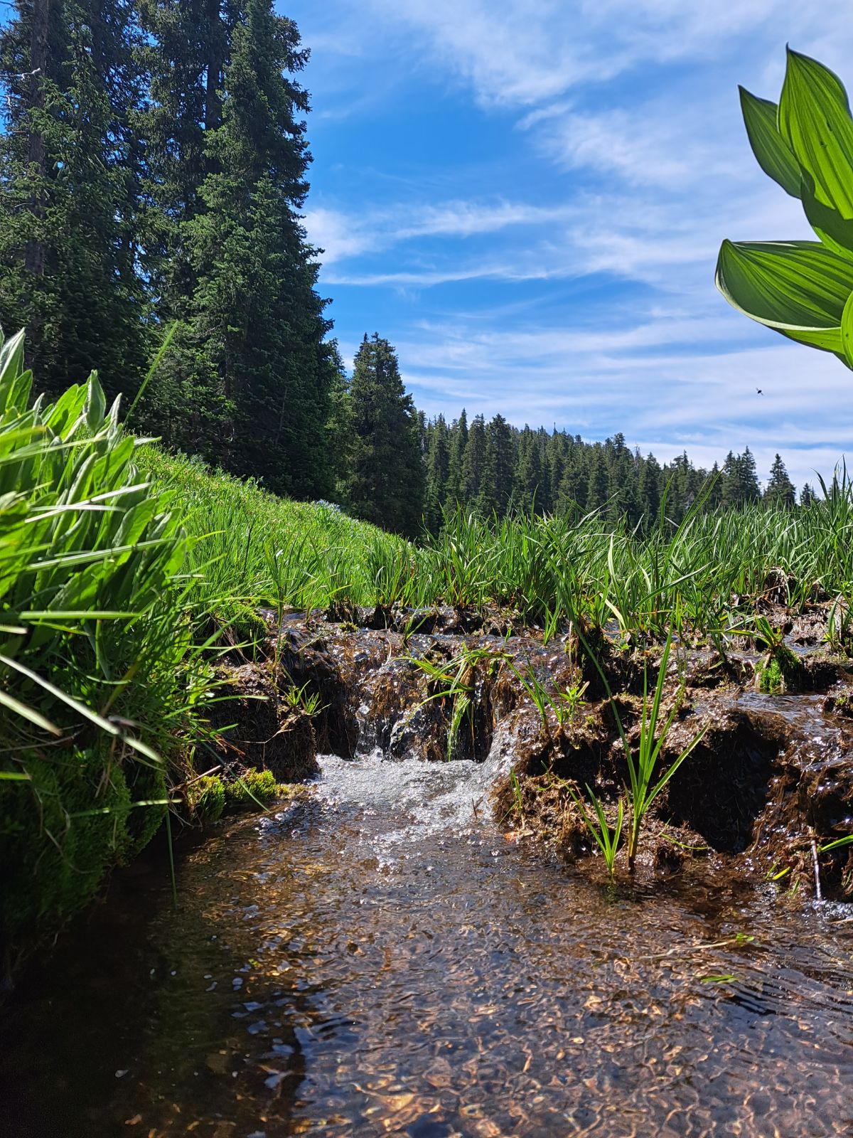
| The next big meadow is further water which can be identified by a spring which provides a small stream through the meadow. |
 |
| We stopped for some pictures. |

 |
| Unfortunately I didn't get any pictures of where we started the ascent of the Signal Peak summit. There is no trail to the top. We went up a rocky "wash" which made for pretty easy hiking, although at a pretty steep grade. Here is a look at Trey descending down the same rocky area to get back to the Summit Trail. |
 |
| It was a hot day with no cloud cover (despite what my phone said). But we each had a camel back and carried a total of 7 additional water bottles. That was just enough for us as we made it back to the car with 1 bottle left. |
