Saturday, May 23, 2020

Sand Caves, Southern Utah

A couple of weeks ago, we read about a hike we thought would be fun to explore for ourselves - the Sand Caves. The Sand Caves are basically what it sounds like - Caves carved into sandstone rock high above UT hwy 89.

There are a couple of ways to get there, depending on where you are coming from. They are located about 9 miles south of the Mt Carmel Junction on Hwy 89, and about .4 of a mile south of Moqui Cave, on the east side of the highway. We took the route through Colorado City and across the Cane Beds to get there and then went through Zion National Park to get back (see map below).

There is a small parking area, or rather turnout, off on the west side of the highway. The unmarked trail starts directly across from the parking area. Before you start, if you look up at the sandstone cliffs across the highway and slightly to the south, you can see the caves.

The trail splits off in many different directions. Don't head directly towards the caves because it would be a very difficult, treacherous, steep climb up the sandstone cliff to get there. Instead, head to the cliff band north of the caves and traverse in a southward direction over the uneven slick rock to the caves. Be careful though. When sand or dirt is on the slick rock, it can make you lose your footing in a hurry!

The caves go back quite a ways and are very fun to explore. They also offer great views of the area below. On our way back we got caught in a lightning storm with flash flood inducing rain while on the slick rock which made it extremely dangerous and challenging to make it back to our car.

The hike is only slightly under a mile round trip but is a moderately strenuous due to the uneven footing on the sandstone cliffs.  Here are some pictures of our adventure:
This is a map of how to get to Mt. Carmel Junction from Hurricane, Utah. The Sand Caves are about 9 mile south of the junction on hwy 89.
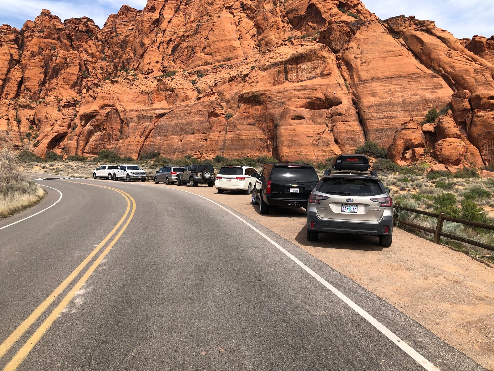
This is the small parking area on the west side of hwy 89 after the rainstorm that hit us as we were coming back. 
From the parking area, looking south-east toward the Sand Caves. You can barely make out the caves just above and to the right of the yellow street sign.
Once you cross the highway, this is what the trail looks like. In the many places the trail splits, make sure to stay to the left (away from the Sand Caves) and follow the north-most trail to the base of the sandstone cliffs for an easier way to the caves.
For the most part the trail is sandy until you reach the slick rock.
Here's a look at the spot where we left the sandy trail and started hiking on the slick rock.

Liz starts the uphill trek...

The Sand Caves are off in the distance. This pictures makes the trek to them look a bit more treacherous than it is. Although it is difficult, my 6 year old made it with us with minimal help. 
Here's a look at the caves just before you enter.

Judi had lots of fun exploring the caves.


And then the rains came, making the trek down incredibly difficult.

We had to pick our way carefully so our hike wouldn't become a slip-n-slide.

You can see the water running down the slick rock in this picture! What an adventure!


Monday, May 11, 2020

Belly of the Dragon, Southern Utah


For Mother's Day, my wife wanted to do a little exploring so we decided to try out The Belly of the Dragon. Originally constructed as a covert under UT hwy89, this tunnel is a great place for families to explore.

Belly of the Dragon is located about a half mile south of the Mt Carmel Junction along hwy 89. From Hurricane, Utah, you can get there from the north by going through Zion National Park or from the south by going through Colorado City and taking the Cane Beds turnoff. We took the southern route to get there through Colorado City and returned through Zion National Park.

Here's a map shot showing the route we took to get there from Hurricane, Utah


The turn off to get there from hwy 89 is unmarked and easy to miss if you don't know what you're looking for. Here are a couple of pictures of the turn off if you are heading south from Carmel Junction:
A Speed Limit sign is along the highway just before the unmarked turnoff.

The turnoff is the gravel road on the right where you can see a truck coming back onto the highway.

Here's a few looks at getting to the turn off if you're coming from the south:
The turn off is just past the metal guard on the left. Notice the blue sign on the right.

The turnoff is immediately across the street from this brown sign.

And here's a look as we're about to turn onto the dirt road that takes you to the small parking area.
This is the road that takes you a short distance to a small parking area up ahead on the left side of the dirt road.
Here's a look at the parking area.
Finding it is definitely the most difficult part of the journey. The trail starts off on a dirt road and after just a short walk, you are brought to a 5 foot drop (down climb) to get to the tunnel. The drop isn't difficult for most people but small children will need assistance. 

The tunnel is the highlight of the hike, for sure, as you walk under hwy 89 for about 100 yards. (A flashlight is a good thing to bring with you as there are sporadic rocks on the sandy tunnel bottom that can cause you to trip).  

After exiting the far side of the tunnel, you can take about a quarter mile walk on a sandy trail to a waterfall that had just a trickle of water coming down. We also took a short hike up and around the waterfall to the right to get to the top of it. 

Once above the waterfall, we didn't explore for too long, but the trail continues for as long as I could see. 

Here are some pictures from the hike:

Here's a look at the trail as it starts from the parking area and heads toward the tunnel. The tunnel starts where the dirt road ends in this picture and heads off to the left through the rock band you can see.

Here's a look at the 5 foot drop down into the tunnel.
For scope, here's a picture of me helping my 6 year-old daughter down.
Here's a look at the entrance to the tunnel.

As the trail exits the tunnel, a sandy wash leads you to a small waterfall.
This is the waterfall the wash leads you to...

Taking a step back, we decided to hike up to the top of the falls.

There are a couple of ways to get to the top. This is the way we took...

Here's a look from the top of the waterfall back down below.


Thursday, March 26, 2020

Jenny's Canyon, Snow Canyon State Park

A great short hike in Southern Utah is Jenny's Canyon, in Snow Canyon State Park. Snow Canyon does require a $10 entrance fee (as of 2020) and found the international spotlight when Katy Perry filmed part of her 2016 Olympic Anthem, 'Rise" there.

Located about 14 miles northwest of St George, Utah on Bluff Street/State Road 18, Snow Canyon boasts a variety of different terrains and colors. Snow Canyon has both a North Entrance (located off of State Road 18) and a south entrance (located off Snow Canyon Parkway).
Here's a look at the parking area for the Jenny's Canyon hike.
From the South entrance, Jenny's Canyon is the second trail you come to and has a small parking area located on the east side of the road, where the trail head is located.

Jenny's Canyon is a fun short hike that leads to a small slot canyon and an overlook. The trail starts over even, sandy terrain and then has a short section of uneven walking over small boulders to get into the slot canyon (Jenny's Canyon). It is a very short slot canyon - maybe 100 yards long. As we hiked through the canyon we heard a large bird who had made a nest in one of the canyon walls overhead.

On our way out of the canyon, we decided to follow a break off trail to the overlook. It is a very short walk to the overlook which looks back towards the parking area.
Here's a look back toward the parking area from the overlook.


In total, the hike was about a half mile, out and back and was perfect for my 6 year old.

Here are some more pictures from the hike:


Almost to the sign indicating the trail split to Jenny's Canyon and the overlook, the trail becomes a little uneven and rocky.
Exploring Jenny's Canyon


Here's the sign that indicates the trail split.
Judi, on her way up to the overlook.

To be continued...

Saturday, February 1, 2020

Zabriskie Point, Death Valley National Park


On our way to the High Sierra's from Southern Utah, we drove through Death Valley. While on this fun side trip, we thought we'd take a short hike up to Zabriskie Point, located about 5 miles south of the Furnace Creek Visitors Center off of Hwy 190.

At just less than a half mile, the hike is really nothing more than a short walk, with a slight elevation gain on a paved trail. The hike is only made difficult by the temperature outside. It was so hot when we hiked it that Liz's phone turned off. Other trail heads can be accessed at the Zabriskie Point Trail head, but we stuck to the main, paved trail. Here are a few pictures of our adventure:
Here's a look toward Zabriskie Point from the parking area.
Taking some pictures with the parking lot in the background.

Here's a look at the desert surroundings.
I took a few shots of some of the educational signage. Unfortunately the sun created quite a glare...


Our whole family at the end of the hike.
You know it's hot when your I-phone stops working...