Monday, July 24, 2023

Petroglyph Point Trail, Mesa Verde National Park 2023

 June 29, 2023


Although the Spruce Tree house has been unfortunately closed since 2015, the Petroglyph Point Trail is a great way to see the tree house from a far and also hike close to some smaller structures. Along the way the trail also takes you to some really neat petroglyphs. The trail which starts at the Spruce Treehouse Overlook near the Chapin Mesa Museum, is a loop trail that is about 2.4 miles long. It is listed as strenuous on the official website, but I was able to hike it easily in late June with my 16, 14, and 9 year-olds. The trail is well marked and easy to follow and starts by winding its way just below the rim of the canyon and returns to where it started by ascending to the rim of the canyon and leisurely making its way back to the trailhead There is only one spot that might be difficult for the elderly or people with conditions that limit mobility and that was just past the petroglyphs which requires a 4 foot climb to start the ascent back to the rim of the canyon. Here's a look at the hike in pictures:


This is near the Museum where the Spruce Tree House overlook is and where the Petroglyph Point Trail and Spruce Canyon Trails Start at the same place.

Here's a map of the area.


A look across the canyon at the Spruce Treehouse.

My daughter, Judi, and son, Trey, on the trail.


Here's where the Petroglyphs Point and Spruce Canyon Trails split. Up to this point from the trailhead, they are the same trail. We took the left to the petroglyphs.

A look at the trail not long after the trail split. It is easy to follow, but at times it isn't on level ground.

One of the few grotto's the trail passes through on the hike.

Here's a look at one of the ruins that the Petroglyph Point Trail takes you to.

An optional, difficult climb off of the left side of the trail will take you to what is left of another old ruin.

Judi also had fun exploring the natural caves along the trail.


We took a rest at the petroglyphs to have some snacks and enjoy the beauty of the area.


Just past the petroglyphs, the trail starts climbing toward the rim of the canyon. Here's a look at my 9 year old, Judi, using the foot holds that have been carved into the rock to help her climb up to get to the trail (where my son is in the background).

Once up the 4 foot climb, the trail continues ascending over uneven ground.


Once back to the rim, there are some amazing views...

...and the trail flattens back out.

I was originally planning on doing the Spruce Canyon hike, but when I saw the sign for the petroglyphs, I decided to go check them out, not realizing that it was the Petroglyph Point Trail. The 2.4 mile hike took us about one hour and 20 minutes to finish. 

Saturday, July 22, 2023

Hovenweep Castle Hike, Hovenweep National Monument

June 28, 2023 

We decided to take a family trip to 4-corners monument, Hovenweep National Monument, and Mesa Verde National Park. After stopping at 4-corners, Hovenweep was our next stop and we decided to take a quick hike to see some of the ruins. We stopped at the Visitor Center to have our passports stamped but it was closed. The trail we wanted to take, the Hovenweep Castle Trail, was also located just behind the Visitor Center so we found it and headed on our way. The hike takes to past several old ruins from a Unit-Type structure to a structure built across the gully under an eroding boulder, and finally to the Hovenweep Castle. The trail is very well maintained and easy to follow and should pose little to no difficulty to even the most novice hikers. It is really more like a walk on a dirt trail. There is very minimal elevation gain and loss and even at the end of June in the 90 degree heat, it wasn't a problem for myself, my 16 year old, 14 year old, or my 9 year old. When we got back to the Visitor Center, we got a drink from the drinking fountain. The hike was a little under a mile long and took us about an hour at our leisurely pace.

Here are some pictures of the hike, ruins, and the trail:

Here's a look at one of the first ruins you come to - the Eroded Boulder Houe. It is across the gully.


A very short distance away is the Unit Type House which is closer on the same side of the gully, but roped off so you can't go in it.


Here's a look at the trail just past the Unit Type House on the way to the Hovenweep Castle. As you can see there is no shade so if attempting this hike in the summer and the heat bothers you, wear a hat, long sleeves, and bring plenty of water. 


A look at Hovenweep Castle...


Here's another look at the Hovenweep Castle with another ruin just off to the right. We didn't hike to this one, but it was a very short hike to get over to it.

The trail does a loop and comes back to a sign that points out many of the ruins along the Canyon.

Back at the Visitor Center after the hike was finished.

Tuesday, March 21, 2023

Gunlock Reservoir Waterfalls March 2023

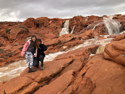
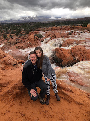
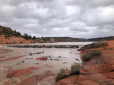
 With an unusual amount of rainfall the past few weeks, the Gunlock Reservoir was completely full and with another storm upon us, we decided to drive to the reservoir and check out the beautiful waterfalls that are made when water flows over the south end of the dam. 

It is about a 1 hour drive from my home in Hurricane, Utah. From the St. George area, you take old highway 91 to Gunlock Road. Once on Gunlock road, it's about 6.4 miles to get to the parking area. You can't see the reservoir from the parking area, which is south of the reservoir, but you can see the waterfalls. (Remember, there will only be waterfalls after the reservoir is full and overflowing which doesn't happen very often). 

Here's a look at the parking area on the west side of Gunlock Road.

From the parking area, find a break in the wood fence and make your way down the slightly steep dirt trail which leads to the falls. 

This is where the trail starts down from the parking area past the wooden fence.


The hike is only around a quarter of a mile and if you enjoy outdoor activities, it isn't difficult at all. But be aware that if you're visiting to see the waterfalls, most likely the ground is wet and much of the hike is through dirt, which becomes muddy, and over slickrock which can be a little slippery. Still, if you enjoy exploring and don't have any major physical limitations, it is an easy, enjoyable hike.

There are a few use trails but for the most part, you just chose your own path to see the amazing waterfalls. You can also walk to the top of the falls where you can see the reservoir and the water that is pouring over the south end.

We were luck enough to time the hike perfectly when the rain had just started letting up and right before it started coming down hard again. Here's a look at the hike with pictures: