Thursday, March 26, 2020

Jenny's Canyon, Snow Canyon State Park

A great short hike in Southern Utah is Jenny's Canyon, in Snow Canyon State Park. Snow Canyon does require a $10 entrance fee (as of 2020) and found the international spotlight when Katy Perry filmed part of her 2016 Olympic Anthem, 'Rise" there.

Located about 14 miles northwest of St George, Utah on Bluff Street/State Road 18, Snow Canyon boasts a variety of different terrains and colors. Snow Canyon has both a North Entrance (located off of State Road 18) and a south entrance (located off Snow Canyon Parkway).
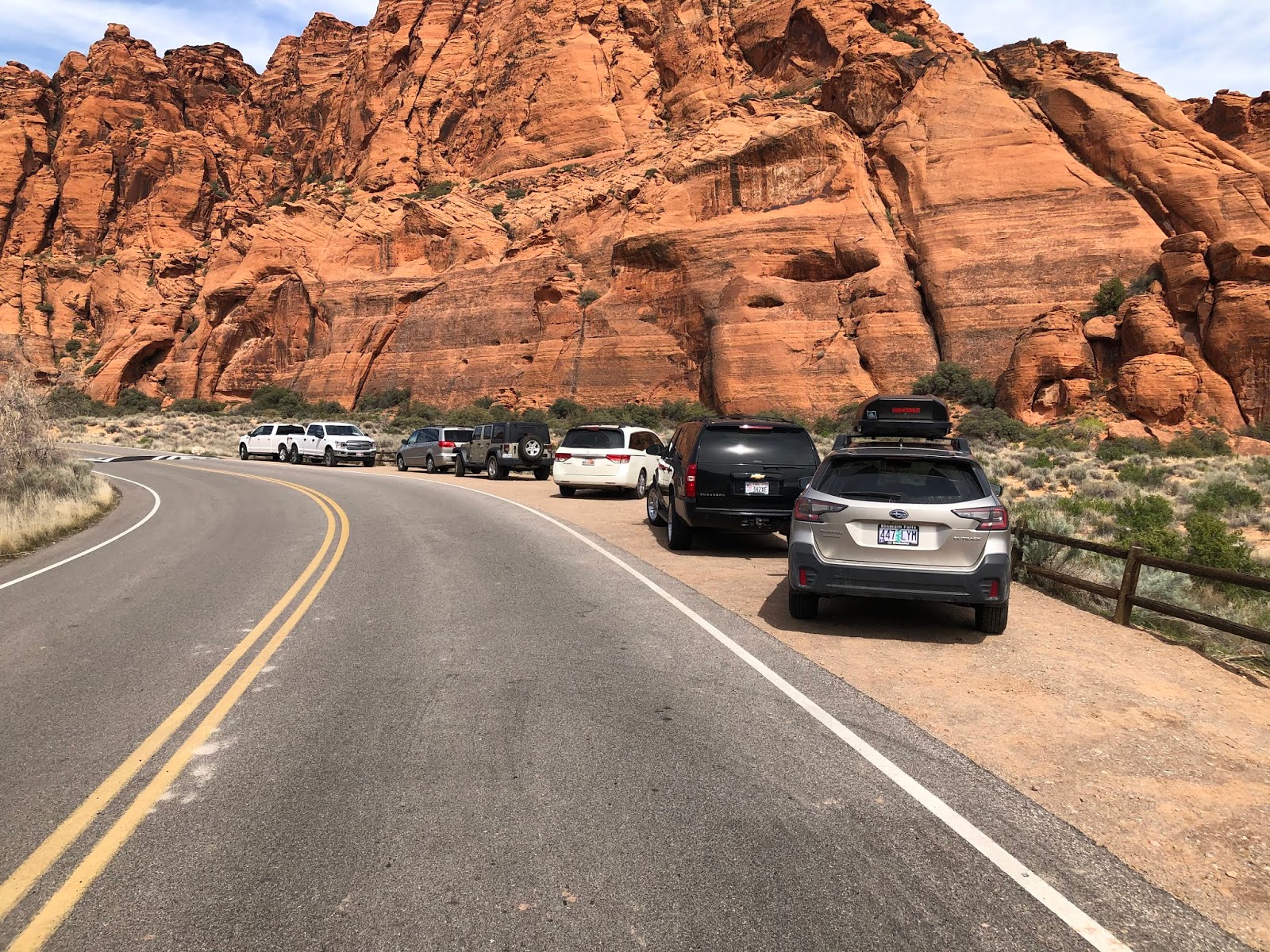
Here's a look at the parking area for the Jenny's Canyon hike.
From the South entrance, Jenny's Canyon is the second trail you come to and has a small parking area located on the east side of the road, where the trail head is located.

Jenny's Canyon is a fun short hike that leads to a small slot canyon and an overlook. The trail starts over even, sandy terrain and then has a short section of uneven walking over small boulders to get into the slot canyon (Jenny's Canyon). It is a very short slot canyon - maybe 100 yards long. As we hiked through the canyon we heard a large bird who had made a nest in one of the canyon walls overhead.

On our way out of the canyon, we decided to follow a break off trail to the overlook. It is a very short walk to the overlook which looks back towards the parking area.
Here's a look back toward the parking area from the overlook.


In total, the hike was about a half mile, out and back and was perfect for my 6 year old.

Here are some more pictures from the hike:


Almost to the sign indicating the trail split to Jenny's Canyon and the overlook, the trail becomes a little uneven and rocky.
Exploring Jenny's Canyon


Here's the sign that indicates the trail split.
Judi, on her way up to the overlook.

To be continued...

Saturday, February 1, 2020

Zabriskie Point, Death Valley National Park


On our way to the High Sierra's from Southern Utah, we drove through Death Valley. While on this fun side trip, we thought we'd take a short hike up to Zabriskie Point, located about 5 miles south of the Furnace Creek Visitors Center off of Hwy 190.

At just less than a half mile, the hike is really nothing more than a short walk, with a slight elevation gain on a paved trail. The hike is only made difficult by the temperature outside. It was so hot when we hiked it that Liz's phone turned off. Other trail heads can be accessed at the Zabriskie Point Trail head, but we stuck to the main, paved trail. Here are a few pictures of our adventure:
Here's a look toward Zabriskie Point from the parking area.
Taking some pictures with the parking lot in the background.

Here's a look at the desert surroundings.
I took a few shots of some of the educational signage. Unfortunately the sun created quite a glare...


Our whole family at the end of the hike.
You know it's hot when your I-phone stops working... 


Sunday, April 7, 2019

Warner Valley Dinosaur Tracks and Fort Pierce


Some friends of mine told me about the Dinosaur tracks near my home so I thought I'd check them out with Judi, my 5 year old. 

To get there from State Street (SR-9) in Hurricane, Utah, take 700 West (Airport road) south for about 2.5 miles until reaching 2060 South. Take a right (begin going west) on 2060 South which will soon turn into 1100 South as it turns around the airport. Stay on 1100 south for about 3.5 miles until it turns into a dirt road. The dirt road "Y"'s as it starts - head straight, not right.


You'll be on this rough dirt road for about 2 miles before coming to a posted sign indicating that the Dinosaur Track Site 7.6 miles away, off to the right. 


From this point the dirt road is very well kept and easy for a passenger car to travel on. There are two more signs, pointing the way to the tracks. For the most part, it's pretty easy to find. As long as you follow the signs and stay on the main dirt road, you'll get there. 

Here's a look at the parking area.

There is a small parking area that can accommodate about 10 cars or so. From the parking area, it is just a short hike to the main dinosaur tracks - maybe a quarter mile or so. A sign and water diversion wall mark the main area of the tracks.

This is where the most obvious tracks are - on the left side of the wall where the people are walking.

Although Judi and I continued past the main sign and wall, I didn't find any Dinosaur tracks other than those by the water diversion wall. The tracks there were shallow but very cool as you could see the length of the dinosaur's stride as well as the direction he headed in. 

Here's a look at one of the tracks next to Judi's foot.
   

After we spent a little while exploring around the tracks, we headed back to the car. We saw a sign on the drive back indicating that Fort Pierce was a little was ahead. After asking Judi if she wanted to go, we decided to check it out (all I had to say was the word "fort" and Judi was in!).

We followed the signs to Fort Pierce on the well maintained dirt roads, the only difficulty being that there are two signs indicating a turn off to Fort Pierce. We took the first one and ended up in a large parking area with an unmarked dirt bike trail head. I decided that I didn't think this was right so I continued on the road and saw another sign for the Fort Pierce turn off not too much farther ahead. 

We parked and headed on a trail below the Fort. It lead us to a neat panel of Indian pictographs. 

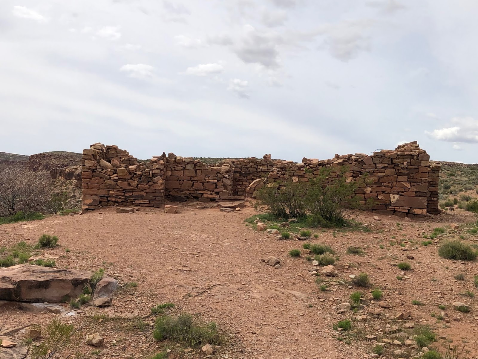
We headed back on the trail to the parking area and then headed up the trail to the Fort. Judi had a great time exploring the small structure and I imagined the early pioneers trying to defend themselves from invading forces. 
Here's a look at one side of the fort.

It was a fun trip that both Judi and I found educational and fascinating.  

Here are a few more pictures from the trip:

Dinosaur tracks:
The first of two signs pointing the way to the dino tracks

The second of the two signs pointing to the dino tracks.

Here's a look at what the well maintained dirt road looks like as you get closer to the tracks sight.

This is the trailhead marking the way to get to the tracks at the end of the parking area.
Here's a look at the sign that has a map on it of the location of the 400+ tracks.

A closer look...

Here's the back side of the sign.

Here's a look at some of the dino tracks...

Judi, by some tracks. You can see how long the stride was by looking at these tracks.


Doing some exploring below the Dinosaur track sign. 
Pictures from Fort Pierce:

Doing some exploring on the trail below the fort...

Here's a look at the whole fort.

Judi enters the fort.

Judi relaxes inside the fort.


Thursday, April 6, 2017

Toquerville Falls


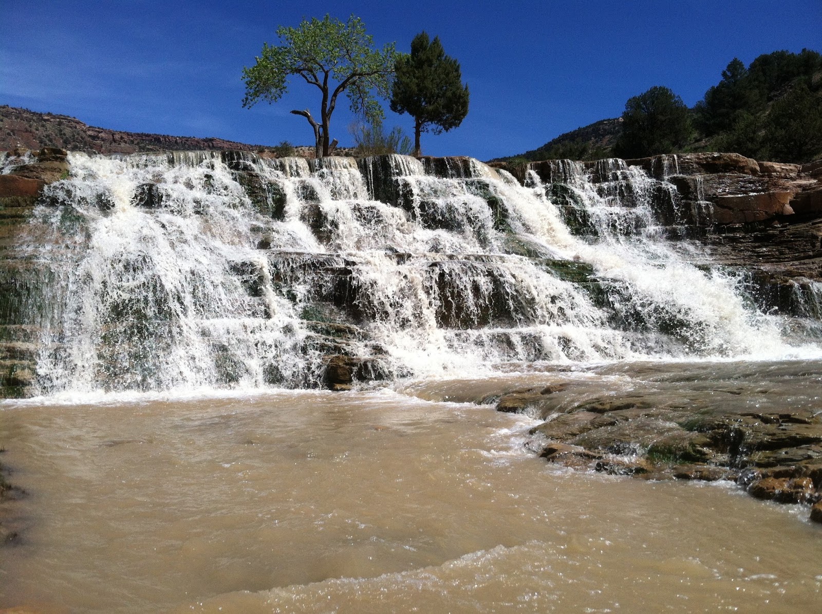
Toquerville Falls is a very picturesque spot along the La Verkin Creek, located just just off Spring Drive in Toquerville, Utah. To get there, you head east on Spring Drive out of Toquerville for 5.6 miles.

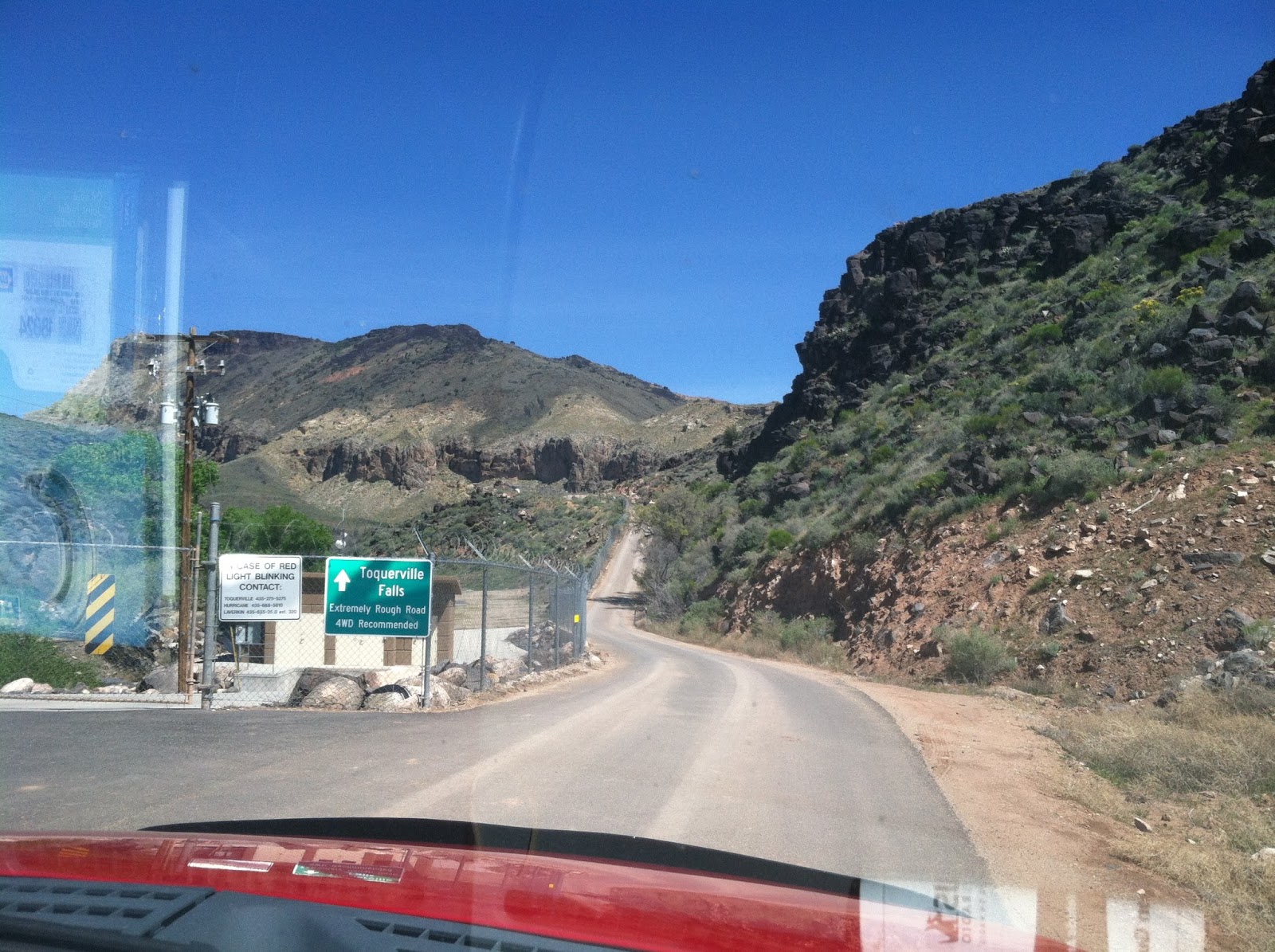
The first few hundred yards are paved but soon the road crosses a cattle guard and turns into a rough dirt road. I attempted to make it to the falls in my Honda Accord but after about 2 miles turned around because the road was too treacherous for a passenger car.

The roughest part of the road is encountered about 2-4 miles from the start. After 3.6 miles the road forks - stay to the right. There is much elevation gain and loss on the road and for a time we wondered if we were on the right road because we had gained so much elevation and could see the canyon that La Verkin Creek was in far below to the right.
If you click on this picture, you can enlarge it to see the falls from the road.

After about 5 miles, you'll be able to see the falls from the road. Continue following the road, which is well maintained at this point, and take a final right as you near the falls.


When we got to the parking area, there were about 20 or so vehicles parked and many people enjoying the falls. I had not expected the falls to be so crowded on a Wednesday early afternoon!

The water was frigid but the falls were beautiful! The water was running much higher and faster than I had seen in pictures probably due to the snow runoff and the recent rains.

Although this really shouldn't be considered a hike, as the falls are about 50 yards from the parking area, it was a fun trip nonetheless.