Thursday, May 2, 2013

Camp Creek, Zion National Park

May 2, 2013

Camp Creek is located a very remote, seldom visited section of the Kolob Canyon portion of Zion National Park. The trail head starts at the north-western park boundary. Knowing that I needed to start getting my hiking legs back under me in preparation for the Grand Canyon Rim to Rim hike in a couple of weeks, I decided to do a moderate hike today.

Looking North: Start hiking along this road.
To find the trail head, Liz and I traveled north on I-15 from St George to exit 42 (the Kanarraville exit). Once off the freeway, we took a right (east) and then a quick left (north) on the frontage road that parallels the freeway, toward Kanaraville. We continued on this road for 1.7 miles until we came to 1925 South, where we took a right. This road twists and turns and forks, but as long as you veer to the left the whole way, you'll eventually be led to a dirt road heading east toward the hills and ending in a small parking area with a signed gate.

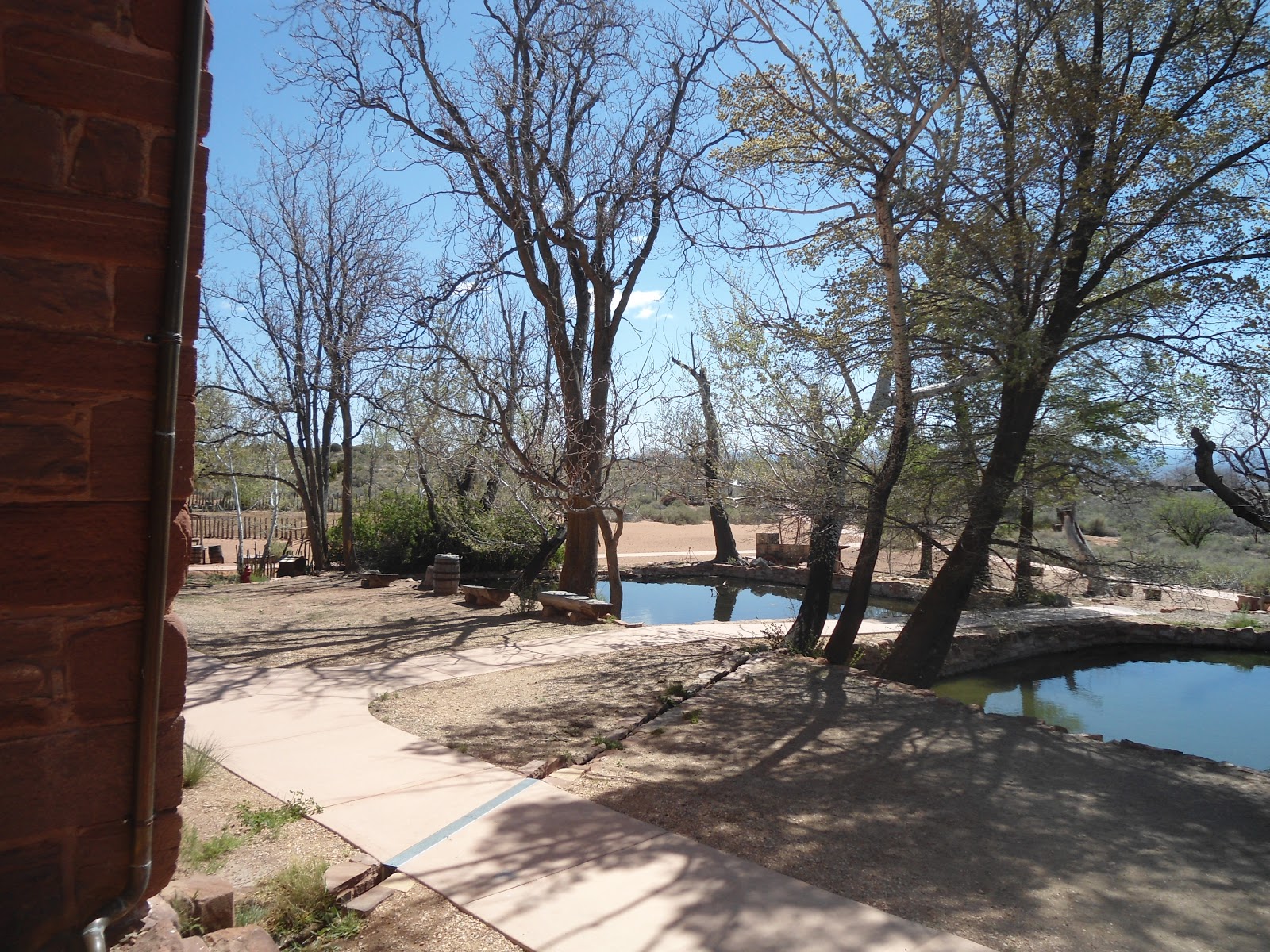
The signed gate indicates that the Camp Creek trail starts through the gate. This is the short trail to the waterfall. To explore all of Camp Creek, you must start out on the dirt road that heads north at the base of the hills.

After a short distance, another dirt road comes in from the right and turns back up the hills. Take this steep road up to the water tank. The water tank is visible from the freeway and can be used to help get you to the trail head if all else fails, as the trail head is about directly below it.

The gate just behind the water tower, marking the entrance into Zion National Park
Once to the water tower, you are about to enter Zion National Park. There is a gate past the water tower on the left, .62 miles from the parking area, that marks the National Park boundary. Once through the gate, the faint trail reached a small dry wash and disappeared completely. We took the wash until we found the trail leaving the wash on the other side.

The trail continued to  take us toward Camp Creek and around the north side of the water fall. At one point, Liz and I heard the waterfall below us and to the south
The Camp Creek waterfall as seen from the trail above.
so we took a short detour to a great view point and took some pictures.

We continued descending down the trail and reached Camp Creek about 1 mile from the parking area, according to my GPS. From here the trail follows the river, although there are faint trails here and there long the river bank.

Because we went so early in the season, we stayed pretty much to the trails along the river banks to keep our feet dry since there was a chill in the air. Had we gone a few weeks later, the brush would have made these trails much harder to follow and we could have just about as easily stuck to the river.

The first mile following the river was easy and straight forward. But soon after the going got a little slower as the river banks were lined with thick trees. We made it through by bushwhacking our way and sticking to the river for a little way.

Trying to climb up the pot holes
About 2.6 miles from the parking area, the river goes under ground and the dry river bed makes the best and easiest travel rout. The canyon walls begin closing in at this point and I was reminded somewhat of my trips down the Virgin River Narrows.

For the next mile or so, we hiked along the dry river bed. At one point we came to a series of potholes, some dry and some still filled with a little water. I had read that we needed to back track a little and climb steeply off to the left to get past them, but being the adventurous person I am, I decided to see if I could climb past them. I made it past about 4 of them but was finally stymied when I came to a 10 foot dry fall. So I backtracked and found that Liz had already found the way up and around the obstacle to the left.

Soon after the potholes, the canyon steepens drastically and to reach the end of the canyon, you gain 500 vertical feet in the final quarter of a mile. The canyon ends at a small waterfall where only about 30 vertical feet of sandstone separate you from the top of the plateau. Getting there, however, is a daunting task that requires a few sketchy moves that should not be undertaken by the feint of heart.

Looking deep into the cave 
If you do decide to try, there is a fascinating cave that we explored back about 40 feet until it got too dark for us to see what was ahead of us, and since I didn't bring my normal hiking backpack, I didn't have my flashlight. I'll have to save the rest of the exploration for another day. This cave is on the right side of the canyon, just a few hundred yards from the end.

Once we finished exploring the cave, we had to steeply descend loose dirt/slickrock, carefully inch our way across steeply sloped sand layered slickrock, and then climb up the steep rocks on the left of the canyon which had the stream flowing over them.


A look at the end of the canyon
After a few minutes of climbing up the rocks and using the brush on either side of us to help pull ourselves up at times (note: beware of the thorny bushes of death!!) we finally made it to the end of the canyon. We were greeted by a large snow field which limited our options for a sitting area to eat or lunch. After 15 minutes, we decided we better head back down.

It took us 3 hours and 40 minutes to reach the end of the canyon, but because we were a little more familiar with where the trail was on the way out, it only took us 2 hours and 15 minutes to make it back down to the car.

In total, the hike was about 8.4 miles round trip and took us just under 6 hours to complete, though we hiked at a more leisurely pace as Liz was hampered by a sore foot.

If attempting this hike, expect your scrambling, route finding, and bushwhacking skills to be put to the test. Also be aware that the very end of this hike requires some sure footing over potentially slippery ground with large drop offs below.


This is the gate at the parking area that leads to the bottom of the Camp Creek falls.


This is where the second dirt road breaks off from the first and the up hill begins!
A view of the water fall and surrounding landscape from the trail.


Liz, sliding down the steep slopes after exploring the cave
 
 
Climbing up the pot holes
Liz by one of the few snow fields we came across
 
Looking back down Camp Creek canyon from the end


Thursday, April 25, 2013

Chuckwalla Trail, Red Cliffs National Conservation Area

April 25, 2013

Liz at the trail head
Liz and I decided to attempt a short, easy hike today because the kids needed rides to and from different activities after school so we needed to be back early. In talking to a customer at work, they mentioned that the Chuckwalla Trail was a fun loop trail when connected with a few other trails.

I mapped out our route, determining that we would take the Chuckwalla Trail to the Turtle Wall Trail, to the Paradise Rim Trail, to the Halfway Wash Trail and back to the Chuckwalla Trail. Because of the numerous trails in the area, staying on the right one proved to be difficult, eventhough most of the trails are well signed.

The Chuckwalla Trailhead is found on Hwy 18 (Bluff Street) just 4 miles north of I-15. There is a large sign on the right side of the road, indicating that the turnoff to the Chuckwalla Trailhead is across the street on the left hand side of the road.

The parking area
We got to the parking area, which has 2 out houses and 2 hikers gates through the fence that surrounds the parking area a few minutes after 11. We were greeted by numerous cars in the parking lot, and 1 school bus, so we knew it wouldn't be a quiet, peacefull hike.

I printed out a map before we left so I knew the location of all the trails. We started through the hikers gate by where we parked our car, and joined up with the Chuckwalla Trail, which actually started directly at the other hikers gate, .1 of a mile away.

Just .1 of a mile in, we saw a couple groups of rock climbers scaling a 50 foot rock off to the side of the trail. We stopped for a few seconds to watch, before continuing on our way. After .8 miles on the Chuckwalla Trail, we came to a trail sign indicating that the "North Crossing" trail descended off to the left, and that the "Beck Hill" trail continued straight. Since the North Crossing trail wasn't even on my map, we decided to continue sraight on to the Beck Hill Trail (the Chuckwalla Trail turns into the Beck Hill trail here). This is where we deviated from our actual plan, and was the source of a little confusion later.

We continued on the Beck Hill Trail for 1.5 miles, taking in the pretty views of volcanic rock off to the north, until it came to a sign indicating that the Gila Trail went off to the right. At this point, the trail that we had just been on, the Beck Hill Trail, seemingly ended into this new trail. But while there was a sign indicating that the Gila Trail was off to the right, there was no sign indicating what trail went off to the left. 

Looking down at Santa Clara
I knew the general direction we needed to go, so I figured we should go left. This was a good choice as it turned out this was the Paradise Rim Trail. The scenery here was the pretiest of anywhere on any of the trails, as we had views of The Ledges Golf course below and the town of Santa Clara. We also past a group of mountain bikers. This short section was the only area of our adventure where there wasn't a real trail. The trail disappeared over slickrock for about 100 yards before reapearing on the other side.

.2 miles after starting off on this new trail, we saw a sign that added to our confusion - The Turtle Wall Trail went off  to the right. I thought we had been on the Turtle Wall Tail when we were on the Beck Hill Trail.

We decided to continue straight on the trail we were on which we still hadn't found an official name for, although we correctly supposed it to be the Paradise Rim Trail. After 3 miles, we finally confirmed that we were on the Paradise Rim Trail as we came to the signed junction with the gecko trail.  

We veered to the left to stay on the Paradise Rim Trail, and after .3 more miles, came to another signed junction with The Gap trail. (The Gecko and Gap trails create a short .6 mile loop that can be added on to this hike).

A trail junction
Again, we veered to the left to stay on the Paradise Rim Trail. We came to the Halfway Wash Trail junction just after .3 more miles, where we headed to the right, to connect back up with the Chuckwalla Trail. It was here, because of another sign, that we realized our mistake of not actually ever hiking on the Turtle Wall Trail, but instead adding another half mile to our hike by taking the Beck Hill Trail.

From here, we went back out theway we came in, again passing the rock climbers. We made it back to our car at about 1:00, just under 2 hours from when we left, and after 4.84 miles of hiking.

Now that I've hikedin the area, it would be easy to know where all the trails are, but because of my newness to this area, this hike proved to be an adventure. Although it would be very hard to get lost if you have any sense of direction, before attempting this hike, I would suggest getting a map of the area (Red Cliffs Reserve Map). There is no water on this hike, and I imagine it would be very hot in the summer. It is a relatively easy hike, although there are parts of the hike where the trail is made up of deep sand which makes the going a little tougher. 
The Beck Hill Trail as it winds past the volcanic rock.


Thursday, April 18, 2013

Pipe Spring National Monument

April 18, 2013

The weather was chilly, so a water hike was out of the question. It had been a couple of years since I had been to Pipe Spring, and I had to this point never blogged about it, so Liz and I thought we better make the hour drive out there and do some exploring.

We left Hurricane, Utah at 10:00am and got onto Hwy 59 (100 south in Hurricane) heading east toward Colorado City. As we started up the Hurricane Cliffs, we saw a sign indicating that Pipe Spring was 44 miles away.

The Drive was actually a bit reminiscent as I passed by some trail heads of hikes that I had gone on in the past, such as Hurricane Canal and Gooseberry Mesa. After about a half an hour we made it to the Colorado City/Hilldale area, which is also the Utah/Arizona boarder. About 10 miles later, after 41.2 miles on Hwy 59, we came to the signed turnoff for Pipe Spring.

Visitors Center
We took a left on Pipe Spring road, and followed the signs for .25 of a mile until we saw the Pipe Spring Visitors Center on the left. We turned in the parking lot, parked, and headed into the Visitors Center to check in with our annual National Parks Pass.

The Visitor's Center has a self guided tour area that contains some neat artifacts and a history of the area and the people who populated it. We spent time walking through this area at the end of our visit.

First, we wanted to go on the hike, of course! The hike is only .57 miles and has many
Liz, on the trail
informative signs along the way. It makes a loop, beginning and ending right by Windsor Castle, the main attraction of Pipe Spring. We started our hike by heading south-west, overlooking the highway that we just came in on.

We read all the signs as we made our way along the edge of the cliffs, and then followed the trail as it turned back north-east toward Windsor Castle. The trail was an easy walk, but helped give us a feeling and idea of what some of the early inhabitants had to work with as far as edible plants and the surrounding terrain.

Windsor Castle
When we got back to Windsor Castle, a Ranger guided tour of the Castle was just ending and one was getting ready to begin (the tours are every half hour). We met the ranger at the massive wooden doors and Liz and I were the only two people there at the time, so we got our own private tour. The Castle was built back in 1870 to safeguard the settlers living in the area from the frequent raids of the Navajo Indians, who just 4 years earlier had killed James Whitmore and his ranch hand while Whitmore was trying to recover his stolen livestock.

A spring (Pipe Spring) actually runs through the Castle and was used for, among other things, a method of refrigeration of food. Also in the Castle was a Telegraph outpost, who's first operator was Eliza Louella Stewart. The Castle also housed many travellers on their way to St George, and elsewhere.  

Retaining Ponds
Retaining ponds were build to hold water from the spring once it exited the Castle and the water was used for watering the livestock and irrigating the garden and orchard. The National Monument is also made up of two additional buildings - the East Cabin and the West Cabin - which housed people from Explorer John Wesley Powell to the Mormon Militia.

It was a very enlightening hike and visit to a very remote, but inviting place.

A look at the Ranch from just outside of the Visitors Center
Trail Sign
Liz, on the trail and under the old telegraph wire
A look at the Arizona Strip from the trail
A plaque on Windsor Castle
The Parlor inside Windsor Castle
The kitchen in Windsor Castle. The stove is the original stove.
This is the room were telegraphs were sent and also the bedroom that the operator lived in.


Thursday, April 4, 2013

Northgate Peaks Trail, Zion National Park

4 April 2013

Most people familiar with hikes in Zion National Park associate the Northgate Peaks trail as one they must take for a short distance to hike the Subway. But the Northgate Peaks trail is a fun, easy trail that rewards those who hike it with great views.

I had the day off work but Liz only had half a day free so we decided to do a shorter hike. Our neighbor, Matthew Arscott, who has accompanied us on a number of other hikes and who is always game for an adventure, wanted to come along too.

So the three of us left Hurricane at about 7:45 and took hwy 9 toward Zion National Park. Near the middle of the town of Virgin, the Kolob Terrace Road, which leads to the Kolob Reservoir, intersects the hwy from the north (left) side. There is a sign marking the intersection. We took a left onto the paved Kolob Terrace Road, and headed up 15.5 miles until we came to the Wildcat Canyon Trail head. There is a short dirt road which leads to a small parking area with restrooms and a marked trail head. 

The Wildcat Canyon Trail head is also where the hike to the Subway starts, so it can be a pretty popular place. When we pulled into the parking lot at 8:30, there were 2 vehicles already there which we later discovered belonged to some campers.

Wildcat Canyon Trail head
We loaded up our gear, past the two trail informational signs and got on our way on the wide, well-defined trail which in some places is actually more of a 4-wheel track. I had been on this part of the hike two times before when I had hiked The Subway, so the pretty pines that the trail wandered through had a nice familiar look to them.

After 1.2 miles, the trail joins up with the Wildcat Canyon Connector Trail (signed), a trail I had been on previously when I hiked the West Rim. At this junction (even though it's not really a junction but more of a merging of trails), veer to the left, but in just about the same direction you were already heading.

Only .2 miles later, a sign marking the Northgate Peaks Trail is on the left side of the trail. The Northgate Peaks Trail actually comes in from the right (south). Turn right onto the Northgate Peaks Trail.

The fork where the Subway route breaks off to the left.
Just a few hundred feet after taking the Northgate Peaks Trail, another fork in the trail is encountered, which is also signed. Here, the route to the Subway breaks off to the left (permit required, as the sign says) and the route to the right continues on to Northgate Peaks. There were a group of campers camping here in between the two trails on a nice, flat meadow.

We followed the Northgate Peaks Trail to the right and continued 1.1 miles from the Wildcat Canyon Connector Trail until we got to the end of the trail - a small peninsula of volcanic rock nearly right in between the Northgate Peaks, and with a great view of North Guardian Angel directly ahead. We also took time to find the canyon walls of the Left Fork (the Subway) off in the distance to the south.

Liz and I at the view point at the end of the hike. (North Guardian Angel in the background).
We took a few pictures and headed back in the way we came. On the way back, we passed a number of hikers who looked to be attempting the Subway (very cold for this time of year). Round trip, the hike was 5 miles long and took us about 2.5 hours on the flat, well defined trail.


Looking south toward "The Subway."

Tuesday, March 19, 2013

Gooseberry Mesa (White Trail to South Rim Trail loop)

March 18, 2013

The weather was supposed to be perfect for a desert hike today and with the day off from work, Liz and I decided that a hike was in order. Gooseberry Mesa is famous for it's mountain biking trails, although an occasional hiker will use them as well.

We left our home in Hurricane, Utah a little after 9:30 in the morning and caught hwy 59 that goes out to Colorado City (also known as 100 south in Hurricane). The highway immediately climbs up the Hurricane cliffs. 13.7 miles after getting on hwy 59, the turnoff to Gooseberry Mesa is on the left side of the road. It is a signed dirt road. The road is, for the most part, well maintained. We took my Pathfinder just in case there were some sketchy parts that my accord would have trouble with. I am very glad I had it because there were 2 or 3 parts of the road - close to the trail head - that would have required creative maneuvering of a low clearance vehicle. I will also note that if it has rained in the two or three days prior to this hike, the roads would probably be impassible for just about any vehicle.

Gooseberry Mesa Trail head and parking area
After driving 2.8 miles on the Gooseberry road, there is a marked junction, indicating that Gooseberry Mesa is to the left. Accordingly, we turned left as the sign said, crossing a cattle guard. This is the road that is a little washed out in spots. About 3 miles after making our left turn, we crossed another unmarked cattle guard, and after 3.5 miles from the turn off (6.3 from hwy 59) we came to the Gooseberry Trail head, restroom, and parking area. Another sign indicated that the White Trail head, which is the trail we planned to take, was a little further ahead and off to the left. So we headed off to the left, as indicated by the sign, but not long after, the road forked and there was no sign indicating which way to go. By luck, we decided to take the right fork, which is the correct way. After 1.1 miles from the Gooseberry Trail head sign, we came to another sign and parking area indicating the start of the White trail head. We also noticed a small sign and gap in the fence marking the start of the South Rim trail. We parked, got our gear together, and started on our hike at 10:19am.

White Trail head and parking area
The temperature was about 50 degrees when we started, with a little breeze and it was cool enough to make me rethink my decision to wear shorts and short sleeves. The White Trail is a well used bike trail, that small mechanized vehicles, such as 4-wheelers, can take as we found out on our hike. The trail isn't very scenic at first, as it meanders through a desert landscape. But after about 3 miles, the trail takes you to some spectacular views off of the north rim of the mesa. From here we could see the little town of Virgin, off of hwy 9 on the way to Zion National Park, as well as some of the land marks from the National Park its self.

View off the North Rim
The junction with the South Rim Trail was soon after the view point, and we followed the South Rim trail further west to the end of the trail - a rock peninsula with drop offs of a few hundred feet on 3 sides. We stopped and took in the amazing views and snapped a few photos before continuing back on the South Rim trail. I will say here that we lost the actual trail in spots here and did a little bit of scrambling to reach the view point at the end of the trail, but we were able to follow it on the way back. It was at this point of our hike that we encountered the first of the dozen or so mountain bikers we saw today.

View off the South Rim
When we reached the junction of the White and South Rim trails, we took the South Rim trail back. Again, we lost the trail a couple of times, but I remembered from looking at maps that the South Rim trail stayed pretty close to the South Rim its self, so when we lost it, we just headed for the south cliff band and managed to find it again. Because the trail stayed along the south rim, the views were great looking down at the highway that we drove in on and toward the former Kokopeli Golf Course. The South Rim trail negotiates a lot of rock. In spots where the trail goes over rock, the trail is marked with white dots of paint, which are very easy to spot and follow.

At one point, about 2 miles from the end of the hike, the South Rim trail gets with in yards of the White Trail, before heading back to the south east. If you're tired, this would be a good way to cut about a mile off of the total hike distance. But if you choose to stay on the South Rim trail, as we did, you will be presented with a nice walk through juniper trees and other pines, quite different from the other parts of the trail.

We made it back to our vehicle after 9.7 miles and 3 hours and 42 minutes of hiking. The trail was a very easy trail as far as elevation gain/loss is concerned. The trail head started at just under 5200 feet and the view point at the end of the hike is just over 5400 feet. Other info: The White trail is 3.1 miles long and the South Rim trail, about 5.9 miles long. You will do a short back track on the South Rim trail to get to the view point.
The junction of the White and South Rim trails