Thursday, September 6, 2012

Ashdown Gorge via Long Hollow

Sep 6, 2012

I will start this report by saying, "What an adventure!" Liz and I decided to hike Ashdown Gorge by starting at the Crystal Spring trail head. This hike requires 2 cars. To get to the trail head, we took hwy 14 out of Cedar City for about 7 miles until we came to a small dirt road on the left - very easily missed. It is just before the new construction due to the landslide which closed the canyon for about a year. Anyway, there is a small parking area there as well as a closed gate which blocks off the dirt road, which is the same road you'll be hiking back on.

We left one car here and continued up canyon to the Crystal Springs trail head. We passed SUU Ranch on the right, Cedar Canyon Campground, and then went through an "S turn" in the road. Right after the "S turn" and 2.5 miles after SUU Ranch, is a small sign on the left hand side of the road indicating the Crystal Springs turn off. From here a pretty well maintained dirt road takes you to the trail head.

We drove for about .7 of a mile until we came to a small clearing at the top of the hill and found ample room to park the car. Not knowing what the rest of the dirt road had in store for my low clearance Honda Accord, and seeing that it went at a pretty steep decline, I decided to park it and hike the road the rest of the way. After hiking it, my car would have been able to make it the remaining .2 miles to the trail head, but I think I'd leave the car where I did if I hike it again.

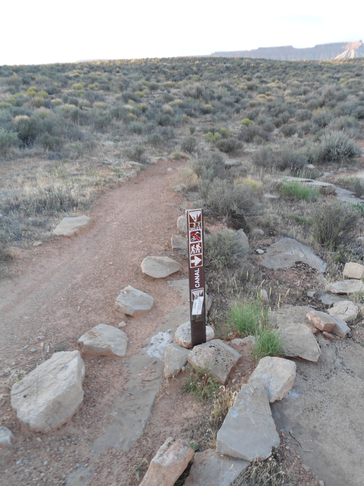
We started our hike at 10:30, hiked the .2 miles as indicated above to get to the real trail head enclosed by a wooden fence, took some pictures of all the signs, and started on our way. Maybe 100 yards after we started, we came to a fork in the trail. A small post sign indicated that the "trail" went off to the left, although no trail name was given. The main trail that we were on (which was really an over-grown old 4-wheel drive road) wasn't marked at all. In studying my map, I came to the conclusion that the crossing trail was possibly the Blowhard trail.

I was pretty certain that we were supposed to continue straight ahead, following the over-grown 4-wheel drive road through expansive meadows. As we kept going, we came to more wilderness signs and the choice we made to go the way we did was confirmed as being the right one. The terrain turned from meadow to forest, with pine and aspen trees engulfing the trail.

Shortly after the trail took us through the forest, we came to a trail sign staked to a tree indicating that the "Black Canyon Trail" went off to the left and the Crystal Springs trail continued ahead. I looked on all 3 of my maps for the Black Canyon Trail but it isn't found on any of them.

A short time later we came to signs indicating the Blowhard trail junction and the Long Hollow trail junction. At the Long Hollow junction the Crystal Springs trail ends and you can take Long Hollow or Potato Hollow. Both trails eventually end up at the same place, the Long Hollow trail taking about 2 miles more to do it.

We took the Potato Hollow trail. A few hundred yards after the trail split, the Potato Hollow trail takes a sharp switchback up the hill side to the right to leave Long hollow, climb the ridge and drop down into Potato Hollow. Where the switchback is, the trail is faint to non existent. Needless to say, we continued on straight, missing the switchback and continuing down Long Hollow. There was no trail so I took out my map to see what we should be expecting. We blazed our own trail for .3 of a mile until we eventually caught up with the Long Hollow Trail even though, at the time, we assumed it was the Potato Hollow trail. So we followed the trail until we reached the dirt road which both the Long Hollow and Potato Hollow trails reach. The road was 3.5 miles from the crystal springs trail head.


The dirt road as seen from the Long Hollow trail
From here my maps and all the trip reports I read said to turn right on the road and take it for .25 of a mile where a trail will break off on the left and take us down to Ashdown Creek - for where the Potato Hollow trail connects to the road, of course...but we hit the dirt road where the Long Hollow trail connects to it, to the south west..

We hiked for .25 miles on the road, keeping our eyes peeled for any sort of a trail but we saw nothing. About a half mile on the road there was an orange construction tie off to the left with a faint game trail by it so we thought it had to be what we were looking for. But as we walked up to the edge of the road, we realized that this was going to be a very steep and somewhat dangerous decent. We descended the insanely steep slope until I could see the far side of Ashdown Creek and the creek its self about 300 vertical feet below. Also, it looked like sheer cliffs would be welcoming us in just a few more yards - or one more slip - below. I decided it would be best for us to turn around and get back to the road before we made it down to Ashdown Creek a lot faster than we had planned.

We all but army crawled back up the slope and continued on the road for about another .25 of a mile until we came to a large mud puddle blocking the entire road, followed by a closed gate. My map showed that the road ended by the river but there was no telling if it would be a few hundred vertical feet above it or right beside it.

So instead of taking the chance - and getting all muddy - we decided to turn around and follow the small stream that we had been following while we were on the Long Hollow Trail. In fact, the map showed that we would be taking Potato Hollow down to Ashdown Creek. The only problem for us was we had no way of knowing what kind of terrain awaited us.

With the backtrack on the road complete, we were back to where we first left the Long Hollow Trail and crossed the road. We hiked over a trampled barbed wire fence and took to the river. At first the way was manageable as we stayed to the left of the creek on a meadow. We came to the remnants of the base of an old log cabin. As the meadow ended we realized that we were already about 25 feet above the stream so we needed to bite the bullet and get back down to the stream.

The bushwhacking begins...

From here, our adventure began. I have had to bushwhack my way through spots before, but nothing like what I was about to go through. The stream got deeper within the canyon walls and thick brush lined the sides of what small riverbank there was. The going was slow and I was glad I had decided to wear long pants as the brush was relentless in digging into my pants and shirt impeding my progress.


We got to a point where we had made it through the thick brush into a temporary clearing of sorts and just when I though I might take a short breather, I looked up only to see right in front of me wreckage from a plane crash. It was an eerie sight. Liz, being the curious one in the family was already starting up the embankment to investigate. I just knew we were going to see some sort of dead body in amongst the wreckage which, to my amateur eye, looked pretty fresh. The plane had been ripped apart in several places but the big chunks of the plane remained pretty well intact. We saw a number of animal bones in the immediate area but fortunately no human remains. When we got home, we did a little research and found out that to our shock, the plane had crashed there on September 4, 1987 and that of the 3 people on the Cessna, 2 had survived. They had taken off from Cedar City on their way to Page, Arizona when they had encountered turbulence and had to crash land in the small side canyon - Long Hollow.  It was a very surreal situation to have stumbled upon this wreckage in the middle of nowhere.

The first waterfall
As we continued on, we heard a deep thumping sound from back behind us around where the wreckage was - the kind of sound you hear when a large dear gallops off after you spook it, only much, much louder. We didn't stop to find out what it was as the whole situation was a bit on the eerie side.

Shortly after the wreckage and a bit more bushwhacking, we came to the first obstacle - the first of 3 waterfalls. It was the easiest of the 3 and only about 8 feet high with gradual drops. We carefully made our way down the mossy rocks and continued fighting our way through the dense foliage.

The second waterfall was a little more challenging and maybe about 10 feet tall. It was at this time that I started to worry about how the river would make it's confluence with Ashdown Creek - would it be a massive waterfall that would force us to turn back and have to climb back up these waterfalls we were coming down? Gulp.

The third waterfall was the toughest. I contemplated turning around but we were already so invested in our route that I tried a little harder to find a suitable way down. We traversed the steep, loose slope to the right and made it around the 30 foot falls.

The end was finally in sight as we could see the far canyon wall of Ashdown Creek. As we got closer, we could even see highway 14 off in the distance. But as I looked up ahead, I noticed that the canyon dropped at a very fast rate as it joined Ashdown Creek. My fears were realized as I looked down ahead and could see the tops of big pine trees that were only tens of yards away.

I knew we couldn't keep following the river at this point. Our only hope would be that the cliff bands above the stream would give us enough room to get around the waterfall and down. I did some reconnaissance around the left hand side while I had Liz stay put until it was determined that it was safe enough to make it down. I determined that we could do it. It would be sketchy in one part and steep for the first little while, but it was doable. And I could finally see Ashdown Creek just about 50 vertical feet below us!

The Rattlesnake under the branches
We slowly and carefully made our way down the steep slope until we finally were down in the Ashdown Creek bed. The last mile or so of bushwhacking had taken us just as long as the first 5 miles of the hike. We turned to go up stream to see if we could find the spot where the stream that we had been following flowed into Ashdown Creek, but just as I was about to step over a log, a faint but unmistakable rattle convinced me to stop in my tracks. I looked down and spotted a fairly large rattle snake about 3 feet away but, fortunately for me, on the other side of a large log. I snapped a quick picture and decided that maybe it was time to head back to the car and end our adventure.

I was hoping to enter Ashdown Creek above the narrow gorge that I had read about but we came in below it. The canyon was pretty, though, and the next little part of the hike, wading through ankle deep water, was somewhat reminiscent of my hikes through Kanarra Creek, Water Canyon and the Narrows.
The final bit of the hike

The landslide that closed highway 14 also managed to disrupt the natural flow of the creek and the last little bit was a bit tedious climbing over boulders and through trees (once again) to make it back. We came to a couple of man made waterways which we bypassed on the right. After the second waterway, the dirt road where we parked our first car appeared and the going from there was easy.
 
All told, the hike was only 7.9 miles and took us 4 hours and 50 minutes. This hike would definitely not be for someone afraid to get scratched or bruised up. Also because the Long Hollow trail disappears in spots, a good map and a knowledge of how to read it would be advisable. I hope to get back there to try to figure out the correct way to make it down to the river.
The large parking area at the trail head. We probably could have drove our car to this point but decided to leave it at the top of the hill.

Signage at the trail head.

This is the sign that confused us just a hundred yards into the hike. The Crystal Springs trail doesn't follow the "trail" to the left. It follows the unmarked 4-wheel track that continues to the right.

The 4-wheel track through the meadow.

Ashdown Wilderness sign.

The trail running through a forested section.

The sign marking the Black Canyon Trail - one that's not on any of my maps.


A look down into the Ashdown Gorge from the end of Long Hollow.


Me in the Ashdown Gorge.

Saturday, September 1, 2012

Hurricane Canal - September 1, 2012

The Hike:
It's Peach Days in the town of Hurricane, Utah and time once again for the annual Hurricane Canal hike. This year I thought I'd go along and get all the history of the canals even though I had hiked parts of the canal on a couple of different occasions with Jeff Frost and Dan Lackey.

We met at Hurricane Heritage park at 6:30am, went over a few things, and then each drove to drop off our cars where the trail ends at the radio tower. To get there, we took 100 south in Hurricane, which turns in to hwy 59, east up the Hurricane Cliffs. Just before we got to the top, there is a turn off on the left hand side of the road with a big dirt parking lot and a radio tower.

The 20, or so, of us that were doing the hike left our cars here and piled into 4 high clearance vehicles that took us to the trail head. We continued up hwy 59 for about another three miles and took a left at another turn out with a well graded dirt road, called Sheep's Bridge Road. Once over the cattle guard, we traveled for about 2 miles on the well maintained road until a single track came in from the left.

It was unmarked and was just wide enough for 1 car to go through. A passenger car might be able to make it on this road depending on the conditions (no rain for a while) but a high clearance vehicle would make it much easier.

After a very short time on this road - maybe a third of a mile - the road splits again and the right fork is signed "Virgin Dam." We took this fork for about a mile and made it to the trail head, which is where the road ends. There is a bathroom and a sign at the trail head.

We signed the register and started on our way at 7:30 before the sun had come up. After a few hundred yards the trail splits. One portion heads straight while the other breaks off to the right and heads down hill. There is a sign marking the way to the canal as being on the portion that descends off to the right.

We were told that the first portion of the trail was constructed about 12 years ago by AmeriCorps. It descends down from the parking area to the Hurricane Canal about 300 feet below. The grade is moderate and the trail well maintained despite several floods that have at one time or another washed out parts of it.

Once down to the Canal, the trail either stays on the ditch riders path or in the canal it's self the rest of the way. Many signs along the way give a brief history of the different portions of the hike. There are 12 caves that the canal goes through, though we only hiked/stooped/crawled through about 8 of them.

At one point, a gate had been put up because an engineer had deemed that one of the caves wasn't as structurally sound as it should be and an alternate route down to the canyon floor and back up to the canal was created. Our guides explained this to us and gave us the option as to which route to take. We all opted to go the way of the original canal.

This portion takes you to a place which has been given the name "China Town" perhaps because of the camps that were set up there by many of the canal workers in the 1890's and early 1900's or perhaps because of the Chinese immigrants that helped teach the locals how to blow holes through the rock with explosives for the canal to get through.

At one time a rock slide completely took out the canal and all the cliff around it. It has been replaced with a 30 foot long large piped section which must be hiked on to continue on the hike. For those extremely fearful of heights, this might make them turn around and take the "approved" route, but all 20 of us made it across, one at a time, and then immediately through a small cave where we encountered a surprised bat.

Immediately after this obstacle, we were met with the China Town bridge. It is an amazing structure for it's time, constructed by a people with not much money. It took the canal from one side of the canyon to the other. In rainy times, a water fall flows from the cliff tops high above and brings with it sediment that has built up in the canal.

We crossed the canal bridge and continued on our way. We noticed the LaVerkin Canal across the canyon from us and spotted an old fireplace and campsite used by the people who constructed the canal.

Another gate crosses the canal with a sign attached indicating that the trail climbs up the hill at that point. I have been up that trail before and it is a steep, poorly maintained trail. Fortunately our guides had us continue around the gate and on the canal. Soon we saw the Pah Tempe hot springs far below with a few people enjoying the natural hot springs. The canal goes right over the hot springs and I looked down and saw many buildings that make up the resort.

We also could see the large Virgin River Bridge that SR-9 crosses to get to the town of LaVerkin. Not long after the hot springs and spotting the bridge, the trail makes it's way out of the canal and up a draw on the left. The trail in this spot is faint and easy to miss so an identifiable landmark to look for is large black rock formations. They make up the far side of the draw. From here, we climbed about 200 vertical feet up to another faint old wagon road. From this point, i spotted the top of the radio tower where we left our cars.

The hike registered 4.48 miles on my GPS, though I was in and out of service. I was told that the hike would be about 5.7 miles. We got back to the cars at 10:25. An hour of our total time was used learning about the history of the canal and taking in the beautiful surroundings.

History:
Construction started on the Hurricane Canal in 1893. Three known engineers said that the canal would be impossible to build but two early settlers - John Steele and James Jepson - took it upon themselves to see that it became a reality. In all, construction took 11 years but on August 6, 1904 water flowed to the Hurricane Valley through the canal for the first time.

All work was done by hand with only simple tools - picks, shovels, crowbars, and a homemade wheelbarrow. When the canal reached a spot where a tunnel was necessary, the workers would skip that portion since they had no explosives and continue the canal on the other side, having faith that they would be provided the means to get through the rock. The canal was to be 8 feet wide with the water running 4 feet deep.

With no way to purchase the explosives or many of the materials needed to complete the canal, James Jepson went to Salt Lake City and convinced the LDS Church to purchase $5000 worth of canal stock. With new funds and the influx of Nevada and Silver Reef miners who were experts in tunneling but looking for work due to the Panic of 1893, the canal was finally completed.

Once completed, workers known as ditch riders would ride on a trail daily that was made with the displaced dirt and rocks from digging the canal to make sure there were no washouts or leaks. During heavy rains, they would ride the canal many times a day, opening diversions in the canal when necessary to let out water to keep the canal intact. Too heavy of a water flow would erode and eventually break through the walls of the canal which were made entirely of dirt and rock.

In 1951, cement was finally used to repair and reinforce the trouble spots in the canal. When massive boulders would fall from above and land in the canal, the ditch riders would build fires to heat the rock and then poor cold water from the Virgin River on top to create fissures that they could get tools into to break down the boulder into smaller, manageable sizes.

The building of the Hurricane Canal was a huge, miraculous undertaking that has allowed Hurricane to blossom into the wonderful town it is today.

The bathroom and sign indicating the trail head
Where the trail splits. The main trail you see on the left continues on along the rim. The trail down to the canal goes off to the right as indicated by the arrow on the sign.
A look at the diversion dam (in the distance) built in the 1985 as part of the Quail Lake pipeline project.
Down at the place where the canal waters left the Virgin River. If you look closely, on the bottom left of this picture you can see remnants of the original dam built in 1912.
This is a picture of the original Ditch Riders trail which is also the trail we used - some 110 years after it was built - for our hike. The canal is on the left.
One of the caves we came out of.
A look down at the Virgin River from the trail.
 
If you look closely, you can see a fireplace that was used by the workers who constructed the canal.
One of the water diversions that the ditch riders would open in times of extreme high water. This would take pressure off of the canal and allow water to flow out of the canal back into the Virgin River.
A section of the canal that was completely destroyed by a landslide. This pipe was used as a replacement for the water to go through.
The China Town bridge.

Right in the center of this picture is the shack built in 1902 to house the explosive powder they used to blow holes through the rock to make tunnels.

 
The pools of the Pah Tempe hot springs below.
One of the last caves to pass through before the hike out.


Thursday, August 23, 2012

Eagle Crags

August 23, 2012

I had to be back in town by 2:00 for a daughters doctor appointment so I knew I would have to go on a shorter hike today. I had a list of a few hikes, but finally decided on Eagle Crags. It is a hike I had first heard about when Dan Lackey, a hiking buddy of mine, and I were hiking a couple years back. Everytime I would go to Zion National Park, I'd glance over at the rugged Eagle Crags knowing that some day I would hike over to them.

To get to the trailhead, we drove to the small town of Rockville just a few miles from Zion National Park, and took Bridge Road south across the Virgin River on a really cool bridge. Bridge Road is very easy to miss if you're not really looking for it, although there is a sign pointing to "Grafton" from SR 9 where Bridge Road is. Grafton is an old Ghost town which merrits exploration in it's own right. It was founded in 1859 and completely abandoned due to flooding and Indian attacks by 1944.

Once you've found Bridge Road in Rockville and headed across the river, the paved road to grafton turns right (west) but the road to get to the Eagle Crags trailhead continues straight in a dirt road. I was nervous about the condition of the dirt road because I had read that a 4-wheel drive is required and after a rainstorm the road can even be impassible for the 4-wheel drive vehicle.

It had rained all day the day before our hike so I was nervous about how the road would look, especially since we had a 2-wheel drive mini-van as our mode of transportation. I had planned on being forced to park just across the bridge and hiking the extra 4 miles to the trailhead (there and back) that this would add to our trip. The first section of road was graded very well and the van had no trouble with it.

Soon, however, the road began to climb uphill steeply and there were a few puddles here and there in small potholes. We made it to the top of the cliff band and continued on to the cattle guard which marks the end of private property and the beginning of BLM land. From here the road deteriorated. Large muddy potholes and washed out road guarded the next dozens of yards of road and I stopped and got out of the van to assess if I thought we could make it any farther. I found a way to navigate between the potholes. Not much passed the potholes, the road began to climb again and huge rocks began protruding once again complicating the drive.

Shortly after we made it up the hill and passed the rocks we came to a small sign on the right hand side marking the Eagle Crags trailhead (about 1.9 miles from SR 9). The trailhead is at an elevation of a little over 4300 feet. We started on the trail at 9:02. The trail is easy to follow as it descends at first down rocky terrain in a south-easterly direction. The trail is surrounded by sage brush, juniper trees, and prickly pear cactus. We took some time to pick a couple fruits off the cactus  and eat, careful not to touch the thin fiberglass like splinters coming out of the fruit.

We continued on, passing an old barbed wire fence that, from what I've read, used to have a hikers gate attatched to it. Today, there was no gate and even the fence it's self was easy to miss. Just before it's conclusion, the trail climbs up some moderate switchbacks and lets you off at the base of Eagle Crags. We continued on to the east of the Crags and a bit south as well until we came to an area with really pretty views into Zion Canyon and Parunuweap Canyon, just east of Zion Canyon. The trail became more faint at this point as it descended farther south along the east side of the Crags. From what I've read, this is an old stock trail that those with a knowledge of the area can take to reach Lower Mountain, Canaan Mountain, and Water Canyon.


We decided to stop here after about 2.6 miles and have some lunch at 11:00. The elevation where we stopped was a little over 5200 feet. The clouds were low and were blocking some of the promenent landmarks of Zion Canyon. After taking some pictures we headed back the same way we came in and made it back to the car at 12:03. The total hike was 5.33 miles and took us 3 hours and 1 minute to complete.
Liz and I at the trailhead. There is also a register at the far left of the picture.

Carefully getting a prickly pear fruit.

Getting the prickly pear ready to eat.

Matthew Arscott and I on the trail.

Where we stopped for lunch and turned around.

Eagle Crags partially hidden in the low clouds.
Where's Waldo?