 never I see the Virgin River I want to hike it! I mapped out a shorter course that would be a pretty easy hike and decided to make the attempt. I had mentioned to Dan Lackey that I was going to do a little exploring in the river and he asked if he could come along.
I had planned on starting right at the Sky Mountain Golf Course. From what I’m told, there is a trail down to the river from near the clubhouse. But Dan mentioned that there was another way that started near his house.
So I dropped my car off at the end of 200 West in Hurricane and had a friend drop me off at Dan’s house where we started the hike about 11:50. We crossed hole number 17 at
 Sky Mountain and dropped down into a side canyon that connects with the Virgin River canyon after about a quarter mile.
The trail down was steep and there was actually a makeshift ladder (although not too sturdy, but sturdy enough) that we used to climb down a 10 foot section. Once to t
 he bottom of the canyon, we bushwhacked our way through some overgrown vegetation and made it to the Virgin River.
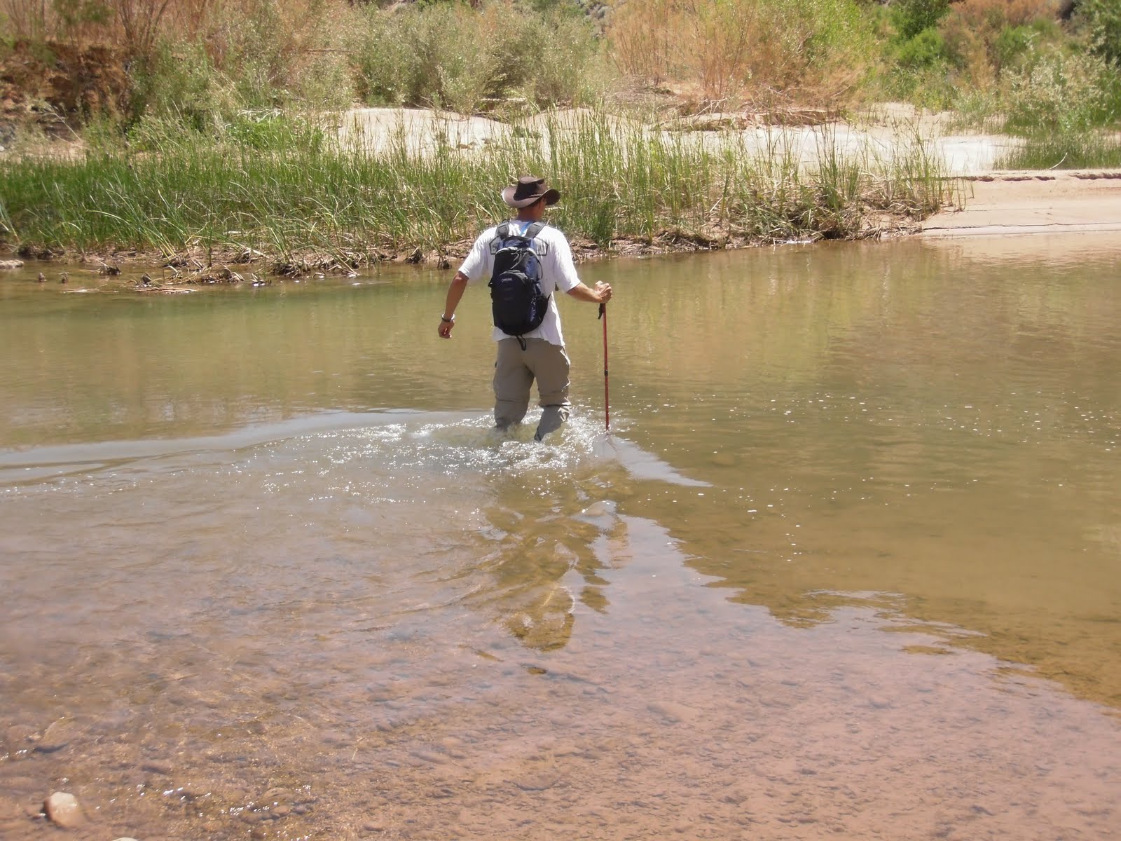
Once to the Virgin river we turned right (north-east) and started up stream. The water felt warm and refreshing - especially when compared to the frigid water I had encountered a month earlier in the Subway. With the temperature reaching 100 degrees, it was nice to get in the water. I have to admit, the first time we had to ford the river, I was surprised by how deep it was.
I soon realized that this wasn’t just a fluke section of the river that was deep, but the whole river was deep and flowing fast! This made hiking straight up stream rather difficult for extended periods of time. But when we got out of the river and hiked along it’s banks, we so
 on found the biggest hindrance of the hike - biting flies!
Fortunately for me, I decided to wear long pants because I was unsure of what type of vegetation we would be forced to hike through. But Dan wasn’t as fortunate in his shorts. The flies were eating him alive, and without any bug spray, we were forced to hike up the river where the water kept his legs covered. It also tired our legs out!
After about 2.75 miles, w
 e came to a small bend in the river with a sheer volcanic face wall. The bend in the river was caused by a huge volcanic bolder that seemingly fell from somewhere high above. The whole scene was amazing and as I noticed the hills that once were very active volcanoes, I found my self thinking about how amazing it would have been to see this area being formed.
It was here also, that we noticed a father and son floating down the river on inner tubes. Although this would seem like a fun idea, even with the river being as deep as it was, there were many spots filled with obstacles that wou
 ld, I would think, require walking the inner tubes around all too often to be worth it.
About a mile and a half past the bend we came to "Rabbit Ears" a volcanic rock formation on the right hand side of the canyon aptly named for what it looks like. Not long after passing rabbit ears, we caught our first look of civilization - some houses off in the distance overlooking the river. I recognized these houses from when I used to take my kids on the hike down to the river, so I knew we were close.
Soon I saw the top of a chain linked fence off to the right hand side which I knew was the top of the desert tortoise habitat and also recognized the
 sandbar that my kids and I played on. So we exited the river and started on the trail past the tortoise habitat that ascended out of the canyon and up to 200 East where my car was parked.
We made it back to the car at about 2:25 after 4.68 miles and about 1000 fly bites! I would definitely do this hike again, but bug spray is a MUST!


