Kings Peak is the high point in the state of Utah. My preparations for Kings peak started weeks before actually leaving for the Hike. I wanted to make sure I knew wher

e I was going and that I had the proper gear once I got there. Shelby had a great time helping me get ready!
I originally planned to go with two other co-workers, but they both backed out so I was left on my own, which had it’s advantages and disadvantages. The advantages being that I would be able to go at my own pace and on my own schedule, but the disadvantages being obviously if something went wrong, I was on my own for 3 days. Also, my imagination always likes to play tricks on me when I’m on my own in Bear and Mountain lion country.

There are two main ways to get to the Henry’s Fork Campground, where I decided to start my hike. The way I went in took me through the town of Lonetree, Wyoming and the way I took home was a different way through the town of Robertson. In the future, I will take the Robertson route both ways as the road is much better maintained than the Lonetree route road is.
The forecast called for thunderstorms Monday, Tuesday, and Wednesday, the three days I had set aside for my adventure. So I was sure I was going to get wet, I just hope it wasn’t going to be a “shocking” experience as well. If I could avoid the lightning, I knew I’d be ok.

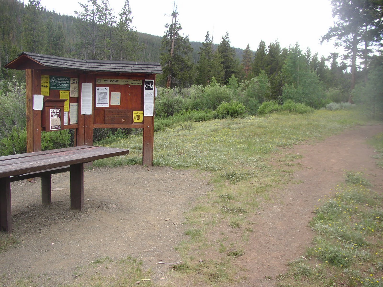
I arrived at the trail head parking lot at 4:10pm on Monday after leaving work in Lehi, Utah at about 1:10pm. After getting my gear ready and using the restroom there, I got started on the trail at about 4:30pm. My plan was to hike into Dollar Lake which I read was about 7 miles in.
The first five or so miles of the hike follows the Henry Fork River on its west side through many lush pine trees. After about 2 miles I saw the sign for Alligator Lake and the trail which breaks off to the right. After about 5 miles I came to the sign for Elkhorn Crossing, th

e lone crossing of the Henry’s Fork River. The sign indicates that you have 2 options: you can follow the trail left and use the foot bridge, or you can continue straight and ford the river.
I decided to use the foot bridge to cross since my shoulders were already feeling the effects of my 38 pound bag. Soon after crossing the river, I was able to see the mountains at the head of the Henry’s Fork basin as the pine forest gave way to huge meadows. Not long after that I had my first view of Kings Peak. The trail still followed the river, this time on its east side for about another mile. At one point the trail became a muddy mess from the many streams draining the snow melt off and I had to hike through some thick brush to avoid getting my feet soaked and muddy.
After about 7 miles I came to a sign describing the rules about camping around Dollar lake, similar to the one I had seen previously for Alligator Lake. But this time there was no trail leading up to the lake. So

I kept hiking for another half a mile until it became apparent to me that I had already passed the Lake. At about 7:40pm I found a good clump of trees that had been used previously as a camp site on the right (west) side of the trail that I thought I would use.
It felt good to finally get that heavy pack off my shoulders! After setting up camp I looked around and saw many rivers and mea

dows below to the west. I took a quick stroll up the small incline to the east of my camp site to look for a lake (maybe even Dollar Lake) to filter some water. I came to a small lake which looked like a perfect water supply for me. As I came to the lake I noticed a Doe and two fawn just on the other side. I snapped a couple of pictures and then filtered some water.
Once back at camp I sprayed my self with some bug spray to keep all the mosquitoes off of me and ate a beef ravioli MRE. By this time it was after 8:00 and the sun was going down. I decided to look around a bit and re-read what was in store for me the next day.
I had decided to get up at first light so I could get an early start and beat the possible thunderstorms the next day. Plus, I never seem to sleep too well on a camping trip so I didn’t think it would be a problem. What I didn’t anticipate was that the full moon was so bright, that I woke up at one point just after 11:00pm and thought it was time to get up until I looked at my watch. The wind blew all night and it sprinkled a little, but not enough for the ground to show signs of it when I got out of the tent the next morning.
At 6:01 I woke up, ate the remnants of my MRE the previous night (some apple sauce and crackers) and got on my way about 6:30. I read a couple of other trip reports about a short cut from Gunsight Pass to Anderson Pass which alleviates all of the elevation loss that the main trail looses going into Painter Basin. But I decided against it since the trip reports cautioned that although it saves about 2 miles and elevation loss, the trail isn’t marked as well and it is a bit more dangerous.
Getting ahead of my self a little to settle which route is more advantageous, while on the summit I talked to a hiker who I saw start hiking right behind me with his brother. They decided to take the “short cut” (which explained to me why I didn’t see them anymore when I would look back after Gunsight Pass). I arrived to the summit about 5 minutes before the first brother, Oren, and passed the other brother who was still ascending on my way down. So I recommend the standard route, which looses about 500 feet of elevation and is about 2 miles longer, because it is easier and takes the same amount of time.

Anyway, back to the report, the trail is easy to follow to Gunsight Pass. Once to the base of the pass, the trail turns right and switches back up to the pass. It took a long switch back at first – so long, I wondered if maybe what I had assumed to be Gunsight Pass, wasn’t really the pass. Once near the top of the pass, I noticed a less defined trail that went straight up the drainage from the top of Gunsight Pass that didn’t look too difficult and would save a lot of time. I thought I would try to take it on the way down.

At the top of the pass, a large cairn, worthy of marking a summit, marks Gunsight Pass.
Once over the pass, there are three trails to choose from. The faint trail to the right is the “short cut,” and the two more defined ones in the middle and to the left meet up about 60 yards down from the pass (one is a switch back and the other is more of a straight down hill trail). This is where frustration set in as I lost about 500 feet of the elevation that I had just gained. But Painter Basin is very beautiful with many little lakes that dot the vividly green meadows. At one point the trail split again, with the left fork heading further into Painter Basin while the right fork headed more around the mountain, which is where I knew I needed to go to get to Kings Peak.
Once around the unnamed peak, I started ascending a steep hill side. At this point I left the main trail because a big pocket of snow was in the way of where the trail went. But after hiking steeply up the hill, I easily found where the trail picked up again and followed it in a westerly direction toward Anderson Pass. At this time I passed 3 other hikers that must have gotten a really early start. They had also gotten off track in one of the snow banks so I helped them find the trail again and went on my way.
Once to Anderson Pass, I looked left toward Kings Peak and noticed that it was engulfed in dark clouds. It was a bit discouraging to see, but I hadn’t heard thunder yet, and it was only about 9:15 in the morning so I decided to keep going. From Anderson pass, if you just turn left (south-southeast) the remaining route is fairly obvious despite there not being a trail for most the rest of the way. It is just a matter of boulder hopping. I should have stashed my trekking poles at Anderson pass to free up my hands for climbing, but I was afraid they might not be there when I returned.
The frustrating feature of the final ridge ascent to Kings Peak is the number of false summits I came to. There were two or three false summits that would get my hopes up only to dash them once I saw a taller summit a few hundred yards away. On one of the false summits, I finally stashed my trekking poles which made the going a lot faster and easier. Fortunately, the dark clouds had lifted off of the summit, though many clouds were forming all around.
Just before the last false summit, I passed a family of 3 who apparently had been the first to summit that morning. They told me that I was almost there but that the summit I saw right in front of me was another false summit, but that the true summit was just behind it.

Finally at 10:05, I made it to the summit, the top of Utah! I had it to my self for about 5 minutes before Oren, the first brother who took the “short cut,” made it to the top. He was from Florida but had already hiked all the Colorado “14ers” (14000 foot peaks in Colorado). I had him take some pictures of me and we talked for a little bit before I headed back down at 10:30.
I offered encouragement to a few hikers who were making their way up to the summit as I headed down. Again the worst part was losing elevation – getting down to 11,400 feet

, knowing that I would have to get back to Gunsight Pass at 11,800 feet. As I got closer to Gunsight Pass, I noticed a number of animals just at the head of Painter Basin. As I got closer, I could tell they were sheep – I had read that they were allowed to graze freely in the basin. There were tons of them!
As I got to the top of Gunsight Pass, I remembered the less defined trail that went straight down the drainage, avoiding the long switchbacks I had used to ascend the Pass. I took the more direct route down. It was very tame compared to many of the steep hikes I’ve been on in the Wasatch range and I would definitely recommend it and take it both up and down in the future.
Once I was safely down the pass, I heard a loud crack of thunder from behind me – sort of near Kings Peak. I worried a bit for the many hikers I had passed on my way down as they were ascending the peak. I was still deciding if I wanted to spend another night in the Uinta’s or if I wanted to head back. The thunder and lightning got louder and louder and I could see now the storm clouds forming to the west.
I determined that if I stayed, I was going to get soaked, so I would try to pack up camp fast and make my way for the car. I arrived back in camp at about 1:15, started an MRE, quickly filtered some more water, and sprayed myself with some much needed insect repellent. I ate a really good beef patty, drank some water with drink mix and then started heading over to my tent to start taking it down.
I no sooner had

the first pole out of the tent than the first rain drops started pelting me in the head. I hurried even faster to take it down before it got too wet. I put my sleeping bag in a water tight bag and strapped it, my tent, and mattress to my back pack and put it on. I actually draped my sweatshirt over my shoulders to cushion some of the weight from my pack, and it really helped.
As I left my camp sight at 2:13pm, the rain really started coming down and the lightning and thunder were still doing their thing over to the west. The rain probably added a few pounds to my pack, but I was determined to make it home that night.
The trip back seemed to take forever. I was beat! All the reports I read before I left said to make it a 3 to 4 day trip and I was beginning to see why. But the constant sound of extremely close thunder kept me at a good pace. I finally made it back to the car at 4:50 and started on the long trip back home. I even took a stranded hiker to Evanston so he could hitch hike back to his car on the Mirror Lake Highway.
I arrived back home at 8:02pm, just in time to see Shelby and tell her all about my trip before she went to bed.
Looking back on my trip a week after I completed it, I would love to spend a few days out there exploring and hiking Gilbert and South King’s Peaks – among the other 13,000ers. It was a rushed but relaxing trip. In total, my GPS registered 27.9 miles, but it was off (low batteries) for about 20 minutes so in reality it was probably about 28.5 miles round trip and my actual hiking time was 12 hours and 16 minutes. I averaged 2.3 miles per hour (rest stops included).


